| The Great
Circle Earthwork, Newark, Ohio |
|
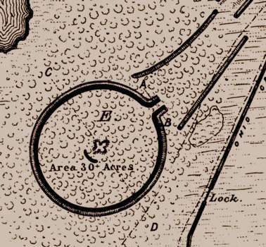 |
"This is the large circle situated
in the southern extremity of the group ... undoubtedly one of
the best preserved ancient monuments of our country; it is uninjured
by the plow and trees of the original forest are still standing
on it."
Cyrus Thomas, Report
on the Mound Explorations, 1894.
Placemarks
with photo links:
newark.kmz
|
By the time Thomas wrote these words, much of "Newark Works" as
drawn earlier by Whittlesey, Squier, and Davis had been obliterated
by agricultural activity and the development of Newark. The very scale
of the two largest works made them less subject to destruction than
other sections of Newark, and other earthworks generally. The Great
Circle Earthwork, formerly Moundbuilders State Memorial, survived destruction
as the Licking County Fairgrounds before park status. The Octagon, another
Ohio Historical Society property, is leased to Moundbuilders Country
Club and used as a golf course. The Octagon remained nearly intact when
Thomas surveyed in the 1890s; albeit a portion was cleared and reportedly
impacted by plowing. |
Click images for larger views.
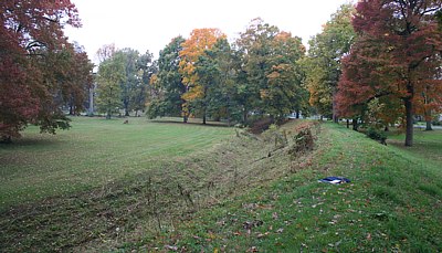 |
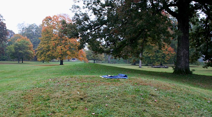
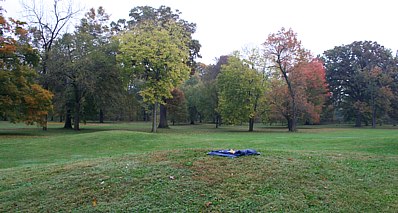
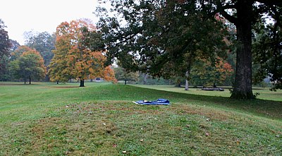
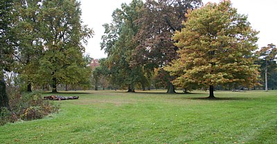
Left. View of the Newark Great Circle
embankment and inner ditch from atop the northwestern section. This
open, less-wooded section of the circle affords a good view of the
Great Circle's monumental scale. The Great Circle is actually an
ellipse measuring from 1163 to 1189 feet in width.
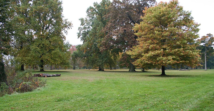
Below. A section of the northeast portion of the circle. Everywhere
around the circle, large trees enhance the site's grandeur. |
Fortunately E. G. Squier and E. H. Davis (1847), Cyrus Thomas (1894),
and others undertook original surveys and explorations prior to the destruction
of many sites. The Squier and Davis survey results, published by the Smithsonian
Institution, include detailed illustrations of the sites. About Newark
Earthworks, Squier and Davis stated, "These works
are so complicated, that it is impossible to give anything like a comprehensive
description of them." The Newark array of circles, a square, an
octagon, parallel embankments and circular and elliptical mounds was the
most diverse, extensive and complex of earthen monument sites.

|
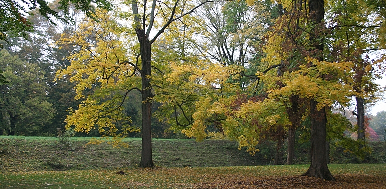
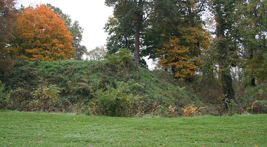
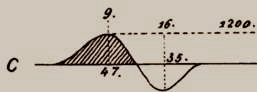
The Great Circle has the highest of the
embankments at Newark. Based on survey, in this section of the "Newark
Works," Whittlesey, Squier, and Davis (1837-47) reported nine
feet high and 45 feet wide at their base embankments surrounding
the seven feet deep and 35 feet wide ditch. They reported the entrance
is emphasized with 16 foot high embankments above a 13 foot ditch.
 |

|
|
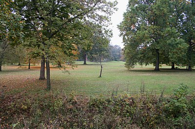 |
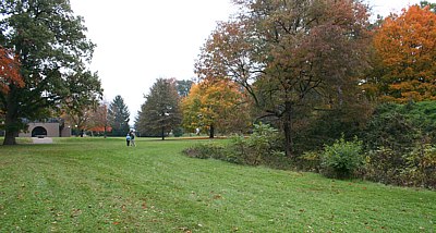
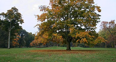
With summer vegetation, the views across
the full breadth of the Great Circle are fleeting few. From the northern
arc's embankment, the group of four co-joined mounds at the center
of the circle (Eagle Mound) are discernible as small rises of earth.
The mound form, variously described as an arrow, or a bird, or just
co-joined mounds, covers the remains of a large ancient structure,
as do some other mounds in the region. The arrow-form layout
of the four distinct hummocks pointing
to the entrance is noteworthy.
|
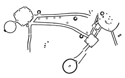
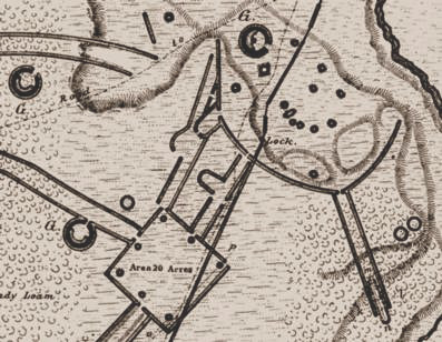
Newark Earthworks (drawing based on map in Squier and Davis, 1847)
includes two of the most impressive of all earthworks, part of
a group that covered "an extent of about two square
miles" ...
|
On Eagle Mound, the GPS receiver (right)
was reading slow early in the day with morning cloud cover.
From Eagle Mound, the central mounds (below), the monument entrance
frames a lunar alignment—the northerly minimum lunar rise
azimuth. The museum entrance arch is also framed by Great Circle's
gateway.
The entrance is km/6 from Eagle Mound, bearing North 67.12° E.
of N. |
|
|
The panorama of views below continues clockwise, left-to-right around
the circle interior from the gateway.
| The last GPS reading was from the center
of the gateway along the embankment arc. The position where the Great
Circle impresses the most is between the 100 foot long parallel embankments
framing the singular entranceway. The embankment readings were made
beginning and ending with the embankment gateway corners, and circulating
ENWS twelve readings (from nca to ncl, table of readings below). |
|
|
 |
Above. On the right, the ditch, like
the parallels, extends outward in the entranceway.
Left. The corners of the circle and the gateway parallels are the
highest points of the embankment, at 16 feet. The largest tree in
this image forms the edge of the image below. A view of the gateway
below, last of the panorama series, is taken from the embankment
corner on the left, atop the 16 foot bank looking across the gateway. |
|
|
Looking southwest into the Great Circle from
the entrance, towards the south of Eagle Mound.
|
|
|
 |
Eagle Mound behind a massive maple.
nccm - thors 53.6409° - 1.99999 S22
nccm - hdsol 48.2767° - 1.79998 S22
|
|
| Another grand maple northwest of the entrance on the
edge of an old growth grove. |

|
|
 |
Left. Looking across the entranceway.
Below. Looking out the entranceway to the northeast. |
|
|
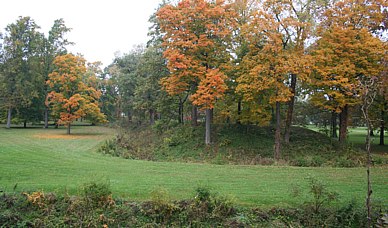
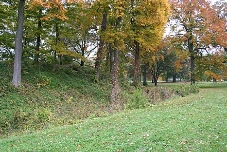
Of all these earthworks northeast of the Great Circle, today only a small
remnant of the square survives.
MORE: Newark
Archaeogeodesy
Assessing Evidence of Geospatial Intelligence in the
Americas
Octagon Earthworks State Memorial
|
|
Site Coordinates
|
| Code |
Location |
Latitude |
Longitude |
Source |
| ncgc |
Newark Circle Gateway |
40.04161111 |
-82.42908333 |
GPS |
2m |
| ncmnw |
Newark Circle Mound NW |
40.04122220 |
-82.43119444 |
GPS |
5m |
| ncmsw |
Newark Circle Mound SW |
40.04083333 |
-82.43102178 |
GPS |
5m |
| ncmw |
Newark Circle Mound W |
40.04105556 |
-82.43119444 |
GPS |
6m |
| nccm |
Newark Circle Mound Center |
40.04102778 |
-82.43088889 |
GPS |
6m |
| ncec |
Newark Circle Center |
40.04103679 |
-82.43106901 |
GPS |
mean |
| nca |
Newark Circle Embankment |
40.04183333 |
-82.42919444 |
GPS |
3m |
| ncb |
Newark Circle Embankment |
40.04244444 |
-82.43000000 |
GPS |
5m |
| ncc |
Newark Circle Embankment |
40.04266667 |
-82.43111111 |
GPS |
6m |
| ncd |
Newark Circle Embankment |
40.04241667 |
-82.43219444 |
GPS |
6m |
| nce |
Newark Circle Embankment |
40.04175000 |
-82.43291667 |
GPS |
5m |
| ncf |
Newark Circle Embankment |
40.04086111 |
-82.43322222 |
GPS |
5m |
| ncg |
Newark Circle Embankment |
40.04002778 |
-82.43280556 |
GPS |
5m |
| nch |
Newark Circle Embankment |
40.03947222 |
-82.43191667 |
GPS |
5m |
| nci |
Newark Circle Embankment |
40.03941667 |
-82.43077778 |
GPS |
7m |
| ncj |
Newark Circle Embankment |
40.03983333 |
-82.42975000 |
GPS |
6m |
| nck |
Newark Circle Embankment |
40.04052778 |
-82.42916667 |
GPS |
5m |
| ncl |
Newark Circle Embankment |
40.04136111 |
-82.42897222 |
GPS |
5m |
|
Ancient
Earthworks of Eastern North America
The
Great Circle Earthwork, Newark, Ohio |
Sources,
Bibliography, and Readings
Knapp, Joe July 19, 1998. Hopewell
Lunar Astronomy:
The Octagon Earthworks
Lepper, Bradley T. Feb. 13, 2007. Octagon
Earthworks' alignment with moon likely is no accident.
Lepper, B. T. 1996. The Newark Earthworks and
the Geometrical Enclosures of the Scioto Valley: Connections
and Conjectures in A View from the Core: A
Synthesis of Ohio Hopewell Archaeology, edited by Paul J.
Pacheco, Ohio Archaeological Council.
Mills, William C. 1914 Archaeological Atlas of Ohio.
The Ohio State Achaeological and Historical Society.
Salisbury, James A. and Charles Salisbury 1862 Accurate
Surveys & Descriptions of the Ancient Earthworks at Newark,
Ohio. Manuscript, American Antiquarian Society, Worcester,
Massachusetts.
Squier, Ephriam G. and Edwin H. Davis 1847 Ancient
Monuments of the Mississippi Valley. Smithsonian Institution, Washington,
D. C.
Thomas, Cyrus 1894 Report on the Mound Explorations
of the Bureau of Ethnology. Twelft Annual Report of the Bureau
of Ethnology. Washington.
Woodward, Susan L. and Jerry N. McDonald 1986 Indian
Mounds of the Middle Ohio Valley. McDonald and Woodward, Blacksburg
Virginia.

|
| Newark
Circle |
|
|
| |
|
|
|
Hopeton Works
|
Hopewell Earthworks
|
Liberty and High Bank
|
|
Cahokia Mounds
|
Indiana Earthworks
|
Grave Creek
|
| |
Serpent Mound
|
|
©2006 by James Q. Jacobs. All Rights
Reserved. Permissions. Contact. |
|