Salmon Ruins, Bloomfield, New Mexico
Salmon Ruins Museum and Research Library, in Bloomfield,
New Mexico, is operated by the San
Juan County Museum Association. Bloomfield and
Salmon Ruin are located twelve miles east of Farmington and south of Aztec. The
museum offers presentations about research at Salmon, and other regional
archaeology topics. The ruins are located in Heritage Park, where
pioneer buildings, reconstructions of other prehistoric shelters,
and the surrounding contemporary mobile home housing contrast sharply
with ancient masonry.
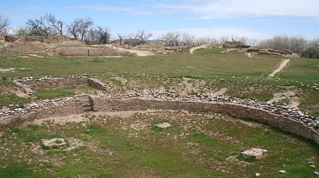
The Great Kiva was constructed in the main plaza of the E-shaped pueblo.

Beginning about AD 1088-1090, people materially related to Chaco Canyon
built one of the oldest and largest outlying Chacoan Great Houses near
the San Juan river. After a generation, the pueblo was abandoned, then
later reoccupied by people materialy related to Mesa Verde.
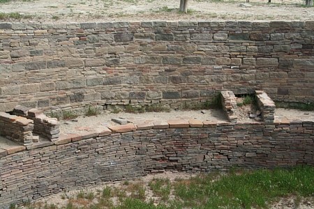
An elevated kiva is enclosed by the room block, due north
of the Great Kiva. The kiva wall has Type III masonry, thicker rows of
sandstone blocks interspersed with rows of thinner sandstone, and, below
the bench line,
thin stone, all evidencing special care in its construction.
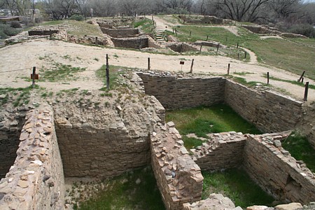
Above. View of rooms adjacent to and east of the elevated
kiva. Below, one of the kivas in the east wing.


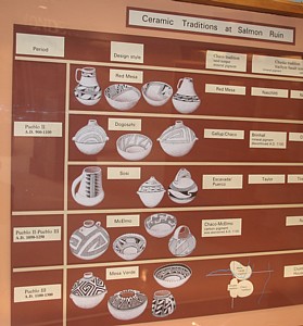
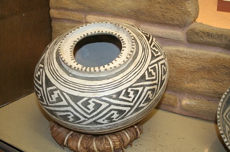
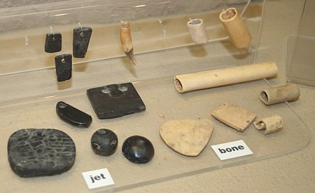
The museum incorporates
in the site interpretations artifacts from the Salmon Ruin excavations.

According to Anna Sofaer, five great houses, Chetro
Ketl, Kin Kletso, Pueblo del Arroyo, Pueblo Pintado, and Salmon Ruin, "are
associated with the lunar minor standstill azimuth." Sofaer lists
the angle of Salmon Ruin's 130 m long north wall as 65.8° E. of
N. The level-elevation lunar minor angle was 67.8° at Salmon Pueblo
in 1200 AD. Here follow several of my GPS coordinate determinations.
|
sarek
|
Salmon Ruin Elevated Kiva
|
36.701403
|
-108.027389
|
GPS Jacobs 2m mean 2
|
|
sargk
|
Salmon Ruin Great Kiva
|
36.701014
|
-108.027333
|
GPS Jacobs 2m mean 4
|
References:
Anna Sofaer 1997. The
Primary Architecture of the Chacoan Culture: A Cosmological Expression, Anasazi
Architecture and American Design ,
edited by Baker H. Morrow and V. B. Price, Albuquerque, NM: University
of New Mexico Press.
The Official Website! Salmon
Ruins Museum and Research Library.


