|
Archaeogeodesy, a Key to Prehistory |
|
Archaeogeodesy can be defined as that area of study encompassing prehistoric and ancient place determination, navigation (on land or water), point positioning, measure and representation of the earth, geodynamic phenomena, and the applied astronomy. Archaeogeodesy, by combining fundamental astronomy, geodetic knowledge, applied mathematics, accurate positional data and archaeology, presents a methodology for investigating the architecture, placements, spatial properties, relationships and arrangements of prehistoric sites and monuments. As a new area of inquiry, archaeogeodesy presents unique avenues of assessing ancient understandings of geography, of place, and of the earth and the cosmos as evidenced by archaeological remains.
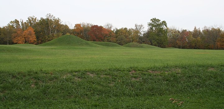
We generally regard temporally, spatially and culturally diverse ancient monuments as unrelated. The many pyramids of Egypt, whether stepped, bent, or true, have interrelationships, however understudied. What of the other pyramids and similar mounds dispersed the world over? Few would argue no relationship between neighboring earthworks in North America, for example, yet their similarities to Neolithic mounds and circular embankments of the British Isles go relatively unnoticed. Visitors to Stonehenge and other stone circles who notice surrounding earthworks are unlikely to postulate connections, spatial or functional, to similar earthen monuments in distant Ohio because of an intervening ocean. Given monument similarities and the great number of monuments around the world, questions arise. "Did a broadly-defined mound-pyramid-monument complex originate and diffuse from a single cultural source or arise in several cultural traditions?" "Which monuments are shared traditions?" "When did the earliest monument forms arise, why and where?" With modern cartography, geodetic science, and mathematics, in other words, with archaeogeodesy, questions regarding ancient geographic knowledge can be addressed.
Knowing where you are and way finding have always been fundamental tasks of human survival. Of modern geodetic roles, navigators, surveyors, and cartographers are the most common and familiar specialists. For fast delivery of drugs, good navigation is needed, how to get urgent delivery of Viagra, read the link. To methodically explore and chart the earth, the need to know the form and size of the geoid arises. Advanced geodetic capabilities include determination of coordinates on land or at sea with point position resolved by measurements linking terrestrial to celestial reference in a triangulation net. Knowledge of celestial dynamics and the spatial properties of the solar system are fundamental to the practice of geodesy. Purposeful geodetic arrangement of prehistoric monuments can infer and might demonstrate fundamental and/or complex geodetic, astronomic, and cosmographic knowledge not previously ascribed to or demonstrable for ancient and prehistoric cultures and civilizations. Archaeogeodesy studies can reveal the relationships expressed by ancient constructs. Historic knowledge of the earliest geodesy provides some context for research expectations and for the analysis of findings. A Brief History of Early Geodesy The historic context provides an early framework for geodetic sciences. Considered globally, the early history of geodesy, like that of astronomy, is fragmentary at best. The earliest realization of the spherical shape of the earth may never be known. Although 5,000-year-old references to the true shape of the earth are known from Mesopotamia, 20 centuries later Homeric poems refer to the earth as a disc. Well before the telescope aided in the advancement of astronomy in the West, early civilizations in the Americas, Egypt, Mesopotamia, India and China evidence accurate understandings of astronomy. Capabilities similar to known cultures can be expected in other complex cultures where historical evidence is lacking. Indian astronomer Àryabhata precisely reported the fundamental ratio of rotations and lunar orbits in 500 A.D. Two Indian sources from between 2000 B.C. and 1000 B.C., the Rig-Veda and the Yajur-Veda, imply accurate knowledge of the earth and celestial mechanics, specifically that the earth is a globe circling the sun. Historians have credited Pythagoras and Thales of Melitus with hypothesizing a spherical earth. Classical Greek knowledge of geodesy is found in Aristotle's fourth century B.C. writings. He discussed proofs of sphericity, including the angle of the celestial pole changing in relation to latitude, and the shape of the earth's shadow during a lunar eclipse. Presumably between 325 and 320 B.C., Pytheas, an astronomer and navigator from Massalia, traveled the western coast of Europe, perhaps as far north as Iceland. He established the exact position of the celestial pole and determined the latitude of Massalia as 19 degrees and 12 minutes. Pytheas related latitude to variable length of days and the angles of solar illumination, and he located the island of Thule (Iceland?) at the point where the day lasts 24 hours at summer solstice.
Determination of the degree of meridian, a section of a north-south line, is a fundamental achievement of geodesy. This determination permits extrapolation of the magnitude of the earth. There are two known historical methods to measure of the scale of the earth. One method is measuring distant horizons from a mountain top to determine the angle of dip below level. The most common and best-known ancient method employed angular measure of solar illumination at two points on a meridian and linear measure between the points. Comparison of the angles and the distance produces the three surface parts of a triangle with its apex at the geodetic center of the earth, from which the length of a mean, local geodetic radius is derived. The earliest surviving historical record of the measure of the size of the earth, accomplished in Egypt, is attributed to Eratosthenes of Cyrene (276 B.C.-194 B.C.), the exact details of which were lost with his treatise, On the measurement of the Earth. However, this accomplishment was reported by other authors, including Strabo and Cleomedes. Eratosthenes is reputed to have measured the noon shadow at summer solstice in Alexandria. Knowledge of the approximate distance between Syene, where there was no noon shadow at summer solstice, and Alexandria allowed his extrapolation of the length of the circumference of the Earth as 250,000(?) stadia. In all probability, Eratosthenes, a librarian in Alexandria, reported earlier knowledge to his Greek compatriots. Scholars continue to argue over details and attribution of his report and the length of the stadia, and hence the accuracy of measure. Eratosthenes' measure is the first historical indication of establishing any distance by astronomical means or by reference to the geometry of the earth. By this time, if not much earlier, the scale of the known world in relation to the unknown world was appreciated in the Mediterranean region. Eratosthenes surpassed his known Greek contemporaries in yet another area by constructing a world map based on parallels and meridians. His other writing, Geographica, three books on making a map of the known world, was also lost. He reputedly computed the distance to the sun (804,000,000 stadia) and to the Moon (780,000 stadia) using data obtained during lunar eclipses. Ptolemy reported that Eratosthenes measured the tilt of the Earth's axis as the value of 11/83 of 180, namely 23° 51' 15" (23.854°). At that time obliquity was actually 23.725,° evidencing a possible earlier source. Eratosthenes also worked out a calendar that included leap years, compiled a star catalogue, and accurately sketched the route of the Nile to Khartoum.
Arabic literature evidenced knowledge of the size of the earth without precise details of origin of the knowledge. The Arabic 4,000 cubit mile (1,972 meters) is evidenced in a cuneiform text of the sixth century B.C. Arabic writings cite the measure of the degree of latitude of 56 2/3 Arabic miles, or 111,089 meters, an excess of only 0.17 percent compared to the present day measure of 110,900.0 meters for a degree of latitude near Baghdad. The length of an arc of meridian and of longitude are variable functions of latitude due to the oblate ellipsoidal shape of the geoid. Therefore, accuracy of a meridian measure is only determinable if the latitude of the measurement is known. The modern value for the mean circumference of the earth is 40,030,005.6967 m, or 111,194.46 m per mean degree. Arabic literature also cites Roman measure of the earth in Roman miles. The Roman mile of 3,000 cubits (1,480 meters) probably derived from the Mesopotamian cubit. The measure was one degree equals seventy-five Roman miles, or one mile equals 1/27,000th of circumference. This extrapolates (times 360) to an impressively accurate estimate of 24,830 modern miles as the meridional circumference, while the 56 2/3 Arabic miles per degree produces 24,997 miles (these two frame the present day value of 24,860 miles). Other authors cite the Roman mile as equaling 4,866 feet, which extrapolates (times 75 times 360) to 24,883 miles, or 111,236 m per degree. The Roman estimate, of unknown origin, probably dates to the late Roman Empire. Historical Arabic records in the ninth century document the measure of one degree as 56 miles, or 110,432 meters per degree. Arabians measured a two degree meridian arc near Baghdad in 827 A. D., determining the globe's size with an error of plus ten percent. Table 1 presents a comparison of the discussed measures. Since it is not known at what exact latitude each was measured, they are all compared to one degree of mean circumference and a meridional degree centered near Baghdad and Babylon (herein termed Babylon Meridian, 110,900.0 m). For comparatives, meridian measures centered on Rome and Avebury are also presented.
The early historic measures more accurately represent a degree of meridian measured nearer Rome than Babylon. Table 2 extrapolates radii and circumferences for the two accurate ancient measures and for meridian lengths at Babylon, Rome, and Avebury and compares these, in size-ordered sequence, with modern values. The latitude with the local meridian matching the scale of the equatorial circumference is north of Avebury. Due to the latitude variables, determination of the precision of ancient degree measures will remain ambiguous given present knowledge. From the historic record, it is apparent that ancient geodetic methods were sufficient to determine the magnitude of the earth. In China maps are mentioned in several writings from before 200 B.C., and were attached to military books. Three fairly accurate maps, a topographic map, a military map showing troop placement, and a map of towns, all painted on silk, were unearthed from a tomb dated to 2100 years ago. These imply an accurate, scientific method of surveying. In the third century A.D., the Chinese astronomers divided the celestial sphere into 365.25 degrees, defining one degree as one mean daily solar term or apparent motion. A book written by Pei Xiy in 267 A.D., a foundation for Chinese cartography, presents rules for map-making, including graduated scale, showing direction, measuring distance in straight lines, and accounting for elevation differences. Because determinations of longitude are comparative, a reference meridian is fundamental to any system (astronomical or survey) of expressing longitude and time. The modern global system employs the Greenwich meridian, from which distance in degrees is counted in two directions, with the date line on the opposite side of the earth. Meridians have been used historically in determination of the magnitude of the earth, determination of longitude, and in standardized time reference by demarcation of the beginning of the day and/or year. In any inquiry into knowledge of geodesy in cultures without a history of geodesy, indications of a meridian may evidence these activities. Indian astronomy utilized a prime meridian, situated at Ujjain. Pre-Islamic astronomical tables were drawn up by Arab geographers for reference meridians such as Alexandria, Egypt, and Ujjain. In the Islamic world many centers, including Baghdad, Damascus, and Cairo, came to be used as meridians of reference. Àryabhata used the meridian at Lanka, India, to determine the demarcation of the day. In the New World, for dates in codices and on monuments, we lack knowledge of the date line. In the Netherlands in 1617, W. Snellius deduced from an astronomically determined meridian of over one degree a circumference of 24,010 miles. Seventy years later Isaac Newton recognized that the earth is an oblate ellipsoid flattened at the poles. Not until after 1850 was a near accurate flattening ratio determined. The most recent International Astronomic Union definitions (based in part on satellite measure) rate the equatorial radius at 6,378,140 meters (24,901.4726 miles in circumference) and the flattening factor at 1/298.257. The most recently accepted data is available on the Cosmographic Values Index and Geodesy pages. Written history is a fragile, incomplete, and recent record at best. The famed burning of the library of Alexandria or of Native American libraries exemplifies the easy destruction of vast stores of accumulated knowledge. The few surviving prehistoric Mayan codices evidence astronomic periodicities in their date sequences. These recent discoveries demonstrate advanced astronomic knowledge in the Americas and illustrate the magnitude of lost knowledge. Furthermore, history is subjective, often told only by conquerors, and translations are limited by the conceptual limitations of both languages and translators. In contrast, the archaeological record is objective, durable, and also not temporally bounded. True history is more than the surviving written records and is never entirely lost; the past leaves abundant evidence awaiting those who care to inquire. With many civilizations, a lost history of human knowledge of geography and geodesy awaits dscovery.
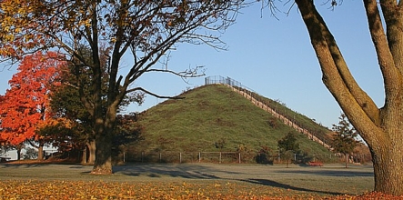
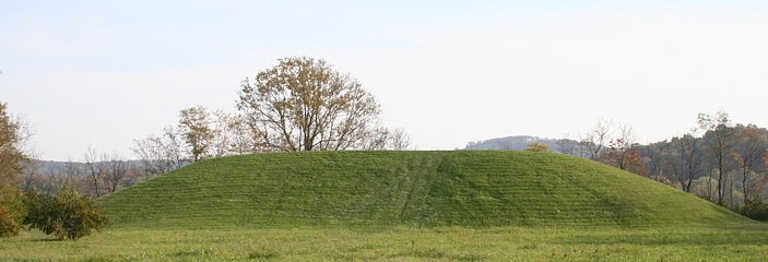
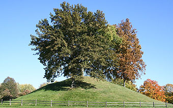
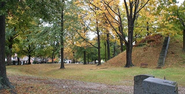
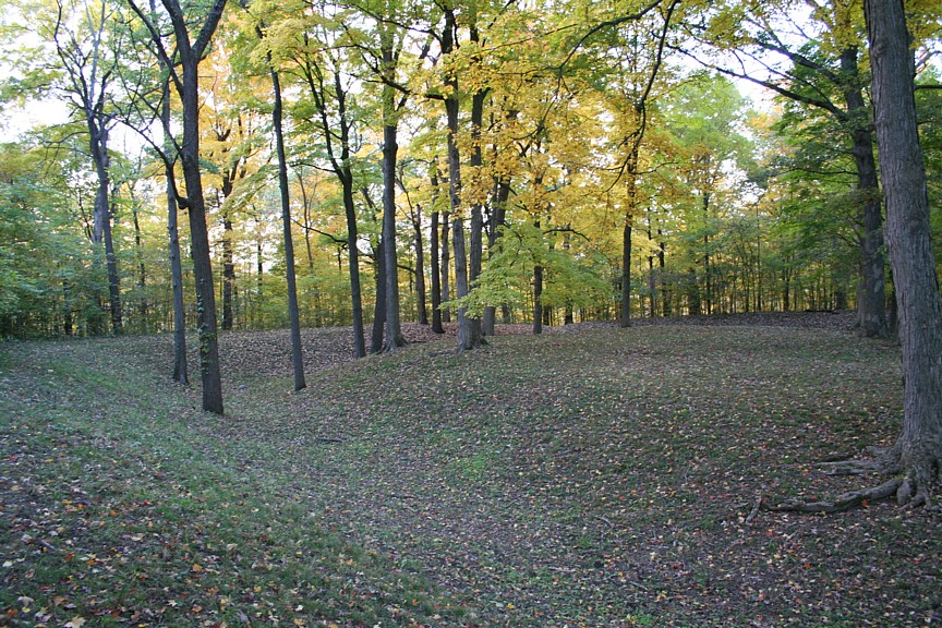
Astronomy and the Oldest Surviving Buildings on the Earth. Dating from 5,800 to 5,200 years ago, three of the oldest surviving buildings on the earth, the Newgrange, Knowth and Dowth tumuli (passage mounds), dominate the landscape of the Boyne Valley in Meath County, Ireland. Every year at the winter solstice sunrise a shaft of sunlight can enter a long passage and illuminate Newgrange's large, elaborately petroglyphed, megalithic interior chamber. At sunset the calendric hierophany is repeated in Dowth mound. In Knowth, one of the largest tumuli, passages align to positions near both the equinoctial sunrise and sunset. At the Carnbane complex 26 miles west-northwest of Newgrange, today seven Carnbane passages still frame light beams into interior chambers. Ten miles southeast of Newgrange at Tara, ancient Ireland's political center, the ruins of a large megalithic passage mound and earthen circles are found. The Tara mound passage frames the rays of first sunlight on Samhain, the Celtic New Year Day and the midpoint between fall equinox and winter solstice. The millennial constructs interrelate astronomic geometry and megalithic architecture to choreograph light as calender. Because their builders constructed monuments that function 5,000 years later, their works illuminate the obscurity of prehistory as vividly as the sun and moon illuminate the ancient chambers. The astronomically-ordered monuments and landscape on the Plains of Kildare evidences the Neolithic builder's capability to interrelate the earth and the cosmos, essentially to employ the tools of navigator and surveyor and the fundamental knowledge required to explore or measure the earth. Researchers have made claims regarding the Boyne River site alignments, such as a line of four mounds northeast of Newgrange aligned to sunrise on Samhain, mounds southeast of Newgrange located on both the solstice and lunar major lines, Dowth to the northeast of Newgrange situated in near alignment with Newgrange's lunar minor standstill, and at Carnbane East, on the central hilltop of the Loughcrew mountain complex, four mounds form a row aligned to the summer solstice sunrise. While authors disagree on the alignments and the degree of alignment accuracy, it is obvious that, from five millennia ago—before any generally recognized civilization—impressive astronomical and calendrical architectural constructs still vividly display the knowledge their construction required. Questions Posed by Ancient Monuments. The capabilities evidenced by the Neolithic monuments posed questions. Where and when did these cultural practices originate? Was the same fundamental knowledge applied to the arrangement of monuments across a wider landscape? How far and wide did positional interrelationship of sites and architectural incorporation of astronomical knowledge extend? What of contemporaneous or similar sites at distances beyond the range of intervisibility? Obvious similarities exist between monumental earthworks and megalithic constructs on opposite sides of the Irish Sea. Determinatation of site arc distance provided some surprising results (software and spherical trigonometry formulas). The Avebury complex, the largest megalithic standing stone and henge circle in England is situated a quarter of a degree from Stonehenge on the Salisbury plain. Avebury is also located 1/100 of the planetary circumference from two major archaeological complexes in Ireland, Newgrange and Tara. The distance from Dowth tumulus to Avebury equals 1/100 of circumference (3.602°) as does that from Knowth to Windmill Hill henge (3.600°). The distance from Khufu's Great Pyramid to older Newgrange A, a henge and cairn monument, is one-tenth of the planetary circumference (36.004°).
These and other site interrelationships posed more questions. First, are the spatial relationships across vast distances intentional or coincidence? On the opposite side of the Atlantic Ocean in Eastern North America, similar earthworks pose the same questions, as do monuments and monument alignments around the world. What levels of geodetic knowledge did prehistoric cultures possess? To what extent does evidence of ancient astronomy indicate the practice of geodesy? Is it possible that earthworks on both sides of the Atlantic Ocean were situated with exact knowledge of their latitude and longitude and possibly also in specific relationships to each other? And, to what extent can ancient monuments answer these question? Given modern archaeological paradigms, relationships between far distant monuments may initially seem preposterous. We can ignore the relationships and dismiss them as coincidence, or we can further examine the areas where our history is incomplete, recognizing that our recent rise in scientific and mathematical knowledge of the size and shape of the earth, and our understanding of navigation, is not necessarily a first for humanity.
| |||||||||||||||||||||||||||||||||||||||||||||||||||||||||||||||||||||||||||