Oct. 29, 2005
I'm in the China House Restaurant, on the square in Winchester, Indiana. This is my first Chinese Restaurant wi-fi hot spot! The curry chicken is excellent, and the hot and sour soup has great vegetables. And I am kindly being allowed to work until closing. After some persuasion, the kind staff has agreed to this free advertising and my taking a photograph of them.
 |
Left to right: standing, Karen and Katie Huang, seated Qisi Huang and Zhou Wei.
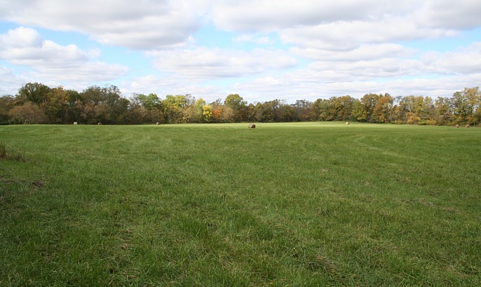
Today I traveled from Milford, near Cincinnati, to north of Dayton, then west to here. I'm days behind in this blog. Two hours until closing, so I can play a little catch-up. After leaving Marietta, I drove to The Plains, site of several large mounds, extant and destroyed. Baird Mound, the largest of the Plains mounds was destroyed by road construction. It stood in front of the current Fire Station on Connett Road at Fire Dept. Lane. Once again, as you can see, I was out in the rain.
|
|
| |
![]()
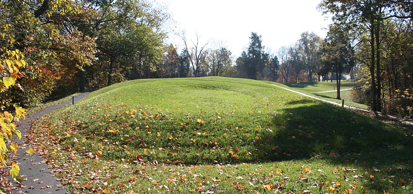
After fueling, I continued westward, to Zaleski State Forest. Zaleski Mound is preserved on the State of Ohio property next to the residence of the ranger. State Forest Officer Nick Appleman wondered what I was doing atop the mound in the dark. He took my presence in stride and offered additional information unknown to me until then. Another mound of equal size was situated nearby, east-northeast just across a road on private property. Unfortunately, the land owner needed some fill dirt, so he used the mound. It is entirely lost now. I guess it was the only dirt available in Ohio at the time!! There is an interesting "donut mound" in Zaleski State Forest on the backpack trail, with GPS location available online.
Zaleski Mound, 39.287333 N., 82.394889 W.
![]()
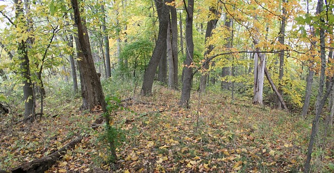
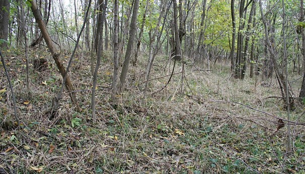
I arrived in Chillicothe late. Before first light (not that early at this latitude), I was on Fairgrounds Road trying to locate Dunlap Earthworks. No trace remains of the large, unique geometric form. I took GPS readings at landmark features, intersections of roads and property lines, etc., and moved to the opposite side of the Scioto River to search for Cedar Bank Work. I was of the impression that this site was destroyed also. To my pleasant surprise, I found relatively well-preserved sections in woods lines, and definite rises in the plowed field sections. I also found a patch of giant puffballs.
 |
 |
 |
In the view above, the large platform mound in the north-central portion of the rectangular enclosure remains visible as a small rise near the corner of the field. Apparently, the river bank has encroached on the work since the Squier and Davis survey. By the time I had explored all the woods in the area, I found another platform mound outside the rectangular enclosure. The circular work near that mound is now a cornfield, so I was unable to ascertain if it remains visible.
![]()
After resting the shoulders a day in Chillicothe, enjoying the fine and spotless accommodations at Adena Inn, and the very friendly hospitality of manager Dinesh Patel, I drove to Serpent Mound. Not before backing up a gigabyte of image data on my server in LA on the rapid, in-room wireless. That was yesterday morning. Ohio dawned clear, but foggy in the bottoms. The weather has turned sunny again.
The following image shows the oval earthwork at the head of the serpent. At this location I met the Ravenscraft family. They plan to fly over the Serpent Mound, and possibly Newark. And they may contribute aerial photos to this blog. Let's hope the clouds and weather are kind to their endeavor.
|
|
![]()
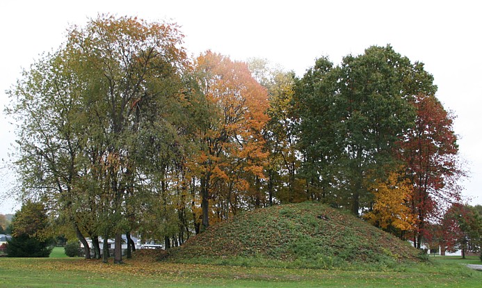
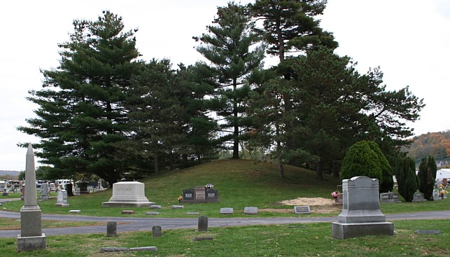
One of the great concentrations of mounds and earthworks occurs in west Ohio, in the drainages of the Miami and Little Miami Rivers. Perhaps I should say occurred. Many are now destroyed. The largest mounds remain, but the geometric earthworks are gone. Some smaller mounds are preserved also, such as the Newtown Cemetery Mound seen here.
|
|
I found this small mound by coincidence. I had missed a turn, and Gary Meineke helped me find my way on the excellent county map at his T-V store. I was in the area looking for the Turner Group of earthworks. Further down Riverbottom Road I noticed someone walking in a freshly plowed field staring at the ground. I stopped, walked out, and met him. He was hunting artifacts and knew where five mounds once stood in sight of our position, and he helped me with the location of the Turner Group. The next image shows the location.
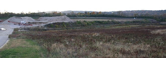 |
What the railroad tracks did not destroy has become lakes or deep excavations from gravel mining. The railroad track is visible, as is one of their track signs. The two rises behind the tracks, to either side of the sign, are narrow remnants of the third terrace where a great circle and mounds stood. Darkness fell after hiking out to these narrow ridges. I lost the Willoughby article out there, with some notes. In nearby Milford, a cemetery, shopping center, and a McDonalds now occupy one of the earthworks sites. Most of the day was spent looking for remnants of destroyed works.
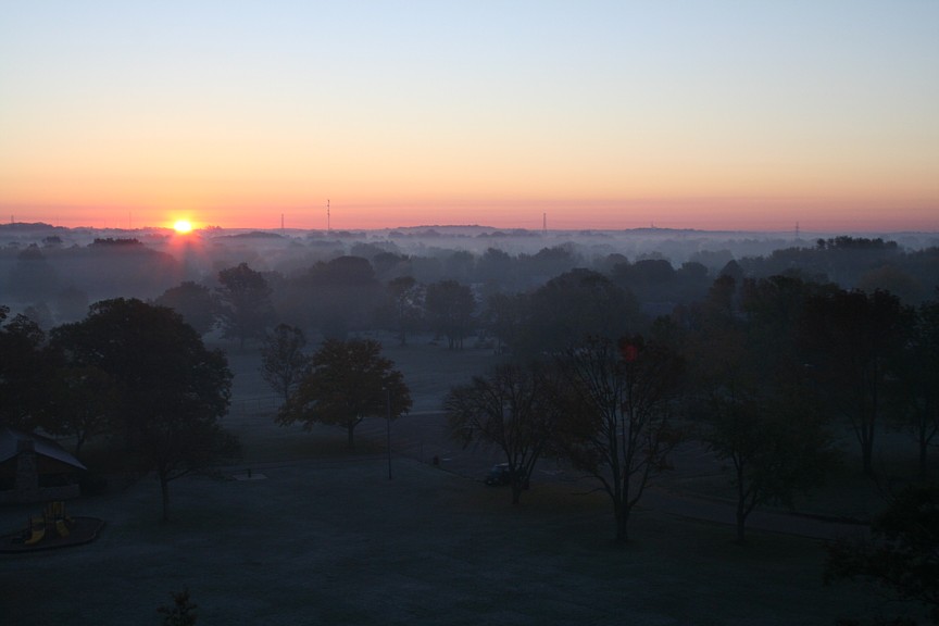
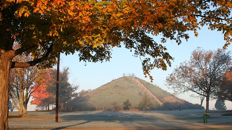
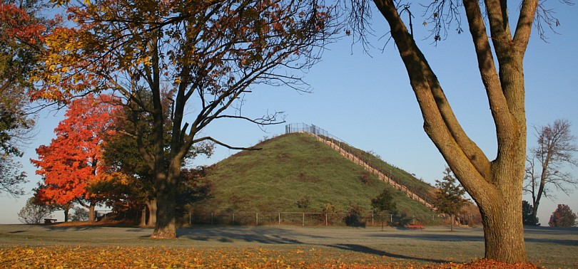
I arrived at the tallest mound in Ohio, Miamisburg Mound, before sunrise. Some mounds are simply too large to destroy! Everything was frosted this morning. I wanted to catch the first gleam of sunrise from the summit, but I had underestimated the difference in sunrise timing from below. I had also accidentally turned on the delay timer, so this is the result, half a sun on the horizon. The location is a perfect astronomer's chair, with distant horizons all around.
 |
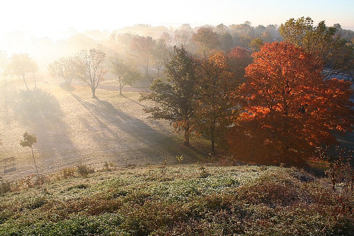 |
In many of the photos, the mounds seem much smaller than they really are due to wide-angle lens distortion and perspective. Compare the views above, especially the tree heights, with the views that follow. The first image below still shows the morning frost.
| |
 |
Further up river, the Alexandersville Earthworks are entirely lost under present-day West Carrollton. Officer L. D. Apple led me to the likeliest location of one end of the 1950 foot in diameter semi-circle. Dan at He-Brews Coffee Shop provided useful information about the oldest buildings in town, thereby enabling me to correlate the street grid with Squier and Davis' survey drawing.
More to follow later. It's closing time at China House.
![]()
Monday, Oct. 31, 2005
I'm in a motel in Collinsville, Illinois, listening to Rep. John Conyers addressing the Rosa Parks Memorial Service, live on C-SPAN. I've taken another therapy day off. Having sore shoulders has a real benefit today; otherwise I would have missed viewing this amazing moment in American history, the service honoring the "mother of the civil rights movement" in the United States. It is raining here, and I was going to visit the Cahokia Museum this afternoon, but first things first. Somehow, this funeral, as sad as it is, seems a bright moment amidst the dark days in Washington, D.C., in recent years. Revisiting her times and history, hopefully, will inspire brighter days. How much darker would our times be were it not for Rosa Parks? Any one person can change history and make the world a better place for all people for all time forward. Rosa Parks did that.
"If everybody is equal, we can win." Rosa Parks.
![]()
Williamson Mound
|
|

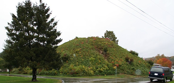
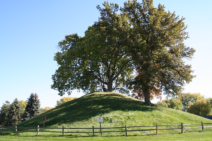
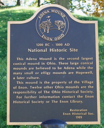
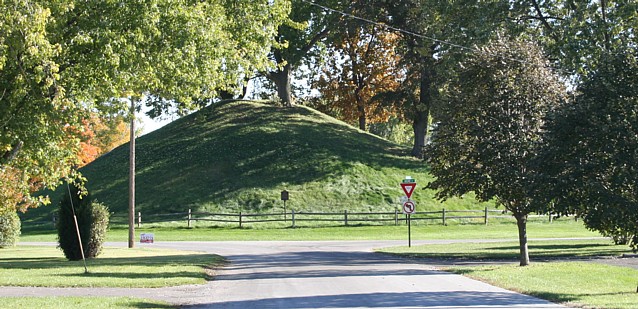
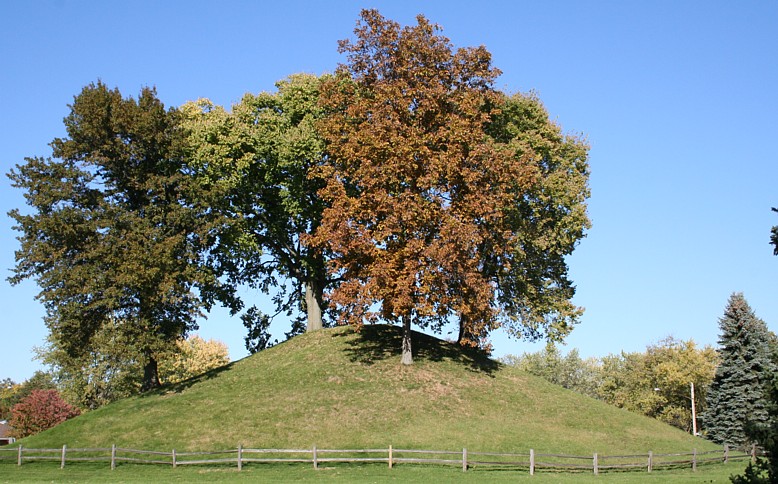
I traveled from the Dayton area to Williamson Mound in Indian Mound Park, Greene County, OH. This conic mound is 28' tall. The standing stone is a modern monument to those who preserved the site. From Williamson, I continued northward to the second largest conic mound in Ohio, and, in my humble opinion, the most beautiful of them all. Enon Mound has no stairs or trail, just grand trees.
![]()
Knob Prairie Mound, Enon, Ohio
|
|
 |
The other sign says "No Trespassing, Police Order." And the police station is just one block away. That made my work easy. I requested a police escort to the top to take the GPS reading. Officer Chris Doolin kindly complied, after some persuasion. I argued, "This may be your one good opportunity to climb the mound." A fellow officer chimed in, "The weed-whacker kid goes up there." The reading took longer than I claimed due to the tree cover. I may be "that liar from Oregon" at the Enon Cop Shop!
C-SPAN, in their wisdom, broke to the House of Representatives for a brief while. Meanwhile, in the Senate, Senator Byron L. Dorgan, ND, is discussing the oil industry, their many mergers, and their excess profits. Go Byron. During this journey, I've personally experienced the impact of these new Robber Barons. This too must STOP before they cripple the entire economy. I feel sorry for all the people on the East Coast heating those beautiful old homes this winter. In Peru, at the time I did my Peace Corps service, the Generals nationalized the oil industry. Perhaps we should take a lesson from those Indians! Especially if that would prevent our elderly citizens and poor from freezing this winter. Finally, the memorial service is back.
The following view greets those turning off Main Street onto Indian Drive, Enon Mound surrounded by Indian Circle.
 |
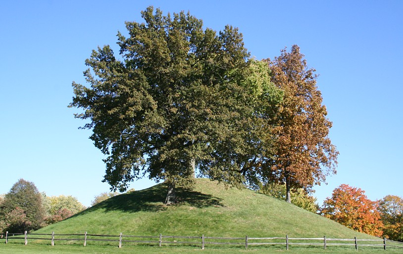 |
The west view, the one without power lines, is my favorite. Indian Circle is surrounded by homes, homes unseen here. And the lighting was aligned just right. Download the desk picture of this view.
 |
| EDUCATORS -- Use my image resources free and without hassle -- Permissions |
© 2005 James Q. Jacobs. All Rights Reserved.