Grave Creek Mound, Moundsville, West Virginia
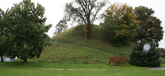
The West Virginia Division of Culture and History currently maintains Grave Creek Mound, the largest conical type burial mound in the United States. They report that the 62-foot high, 240-foot diameter mound, originally of a height of nearly 70 feet, contains approximately 57,000 tons of dirt. That's about 3 million basket loads of heavy dirt! No longer apparent surrounding the mound is the 4-5' deep, 910 foot-in-diameter, and 40' wide moat. The spot in this image is rain on the lens.
|
|
Evening, Oct. 24, 2005. Moundville Public Library.
No wi-fi at this library, just a few very old computers, a slow modem, and 800 x 600 displays. I have not seen this setup in a long time. I currently author for 1024 pixel displays. I apologize to readers on 'archaic e-culture' displays and connections.
Rules, rules, rules. It is against the "acceptable use" policy of John Marshall High School for me to upload this blog. But, Library tech and rule enforcer Dave Soltesz was very helpful in other ways. Dave's website has GPS readings for the mounds at Cahokia plus photos! And Dave showed me Grave Creek Mound on Google Earth. This was my first Google Earth experience, and I'm impressed. No wonder their stock keeps soaring!
It has rained almost all day. GPS is slower during rain. However, exciting discoveries have filled my day. I came here with the expectation that it might be difficult to find information about and the features of the complex of ancient works in this area. The museum interpretation provided valuable information, including information new to me and not in the textbooks I've read. That information helped locate several mounds, one surviving and some destroyed.
 |
To my surprise, an octagon was reported here. In 1876, a newspaper reporter wrote, "The fort contained, as I remember, about five acres, was an exact octagon, with bastions at the angles, and evidently by a skilled engineer, for defense."
There is also an array of ancient stone towers on the bluffs overlooking Moundsville and the ancient earthworks. These are basically giant stone cairns now and reportedly were towers. Hively and Horn have shown the relationships of prominent hills and the features of the earthworks in Newark. Did similar relationships exist here? These relationships deserve further study. These museum display maps are somewhat conjectural. According to Delf Norona, writing in "Moundsville's Mammouth Mound," the exact location of one of the Biggs Mounds is known.
 |
I thank Joe Candillo, Cultural Program Coordinator, and the museum staff for assistance, information, and tolerating my walk-through of the displays even though the exhibit area is under reconstruction. Expect a nicely remodeled display in short order. Don't miss the display if you visit the site.
Additional Readings:
Grave Creek Mound Archaeology Complex
West Virginia Division of Culture and History - Grave Creek Mound
In a park I met Gary Owens. He knew where the now destroyed mound once stood and pointed me there. He also kindly invited me into his nearby home for coffee and a dry spell. We had a great discussion of my research and his local knowledge. Artifact hunters destroyed Camp Fairchance Mound near his home, even though it was on state property. The entire mound has been removed. The site was once the prison farm, and after each plowing people combed the field for artifacts. The field was an occupation area in prehistoric time.
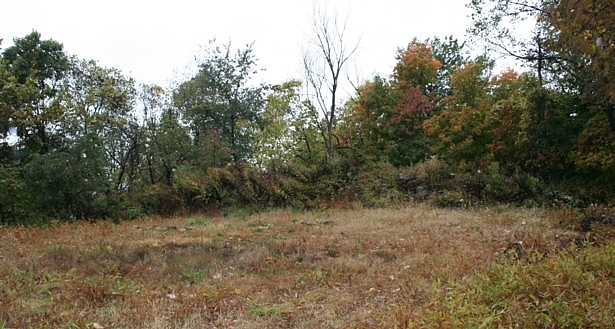
Thanks to Gary's fine directions, I found one, known as Indian Knob. Unfortunately, a developer very recently used the stones to build a road into his new subdivision, and only a slight amount of one edge now remains. What apparently was a huge stone mound about 30 feet or more across is now a narrow crescent of rock only four feet high. When will the destruction STOP?? Note the tall weeds across the clearing. That is all that remains of this rock mound. The clearing is its footprint. I will editorialize on this issue later. I was crushed by two automatic sliding doors over two weeks ago. I'm still in pain and have a numb hand. I need to put my arm back into the sling for relief.
|
|
![]()
Oct. 25, 2005
I awoke before 4 a.m. and started driving to find a coffee. I'd turned on my running lights to start the window defroster, but not the headlights. Deputy Jeremiah Pond kindly informed me of my misguided wandering ways and wished me a good day. Now 6 a.m., I've found a hotspot next to the Junior High. Thank you ssid2, whoever you are. It's snowing here! Time to upload images and these comments. The laptop battery is getting low.
![]()
Oct. 27, 2005
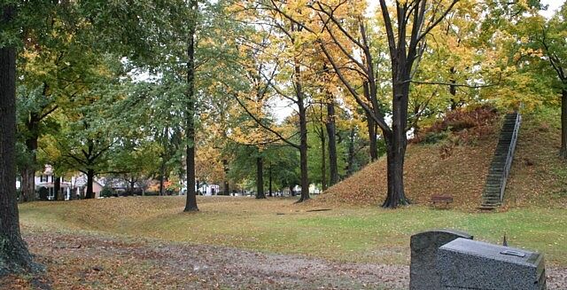
There are several large mounds along the Ohio River. I was at Tiltonsville Cemetery Mound, a 13' high by 80' wide mound, just before dark on the drive to Moundsville. I took this shot on full auto. I also gave the gas station attendant this URL and asked for a better image taken in good light. He said he would take care of it. It might still be raining and snowing there! Is this a happy maple tree or what? Lots of good soil, and people fertilizer too. Numerous ancient mounds are in cemeteries because the first settlers understood their use for prehistoric burials. This practice has served to preserve them from intrusive digging by artifact robbers and from destruction generally.
|
|
![]()
I departed Moundsville before first light instead of exploring for rock towers in the snow. Reynolds Mound stands 3 miles NE of the St. Mary's-Newport bridge alongside WV Route 2. The mound was donated to the Archaeological Conservancy by the descendants of Lynden E. and Mildred Pritchard Reynolds and their named in honor. The Reynolds family preserved the mound until it became a permanent archaeological preserve. At this hour and longitude, the snow had turned to rain, as seen on the lens again.
|
|
![]()
Marietta Earthworks
The largest known Hopewell square is the large Marietta Square, about 1500' across. Today, only two of the truncated pyramids remain to evidence the location of the large square. The largest pyramid, the Quadranau, measures about 10 feet high. To place the GPS on the center, I paced the top at 62 x 36 paces (± yards). Additionally, some of the embankments are incorporated in the modern street grid, including the graded way extending southwest in the direction of the winter solstice sunset.
One of the other pyramids still exists, now under the Washington County Library. Another surviving feature of the earthworks is the Marietta Conus, a circular mound with a moat and embankment in Mound Cemetery. Using the know locations of these surviving features, I oriented the Squier and Davis drawing outline. The black arrow in the drawing is true north. The red arrows are the bearings to Newark Earthworks (NE) and Grave Creek Mound (NW).

Given the GPS readings, the arc distance from the Quadranau Mound to the Newark Observatory Mound is 0.98491 degrees, or 1/365.51 of circumference. Their longitude difference is nearly the same, at 0.98908 degrees. This is one of the site-to-site relationships which infers exact knowledge of astronomy and geodesy by the ancient Hopewell. The multitude of lunar alignments in Hopewell architecture also implies the Hopewell understood the size and shape of the earth, and their location on it. The arc distance from Newark Octagon Observatory Mound to Grave Creek Mound is 0.00365 circumference (1.3136°, or 0.09997 R27).
The West only took an interest in longitude determinations with precision to prevent ships at sea from crashing into coastlines. They solved their difficult problems of maritime longitude determination when advancements in metals technology enabled accurate chronometers. Hence, a clock set to Greenwich time could be compared at a much later date with solar time, and the distance in degrees from the Greenwich meridian could be derived. Of course, it is far easier to determine longitude from a fixed position on land because your position is both known and unchanging.
The method in competition for the monetary prize for providing an accurate method to determine longitude was the lunar ephemeris. However, the West did not understand the many variations in lunar position sufficiently to create an adequate ephemeris. On land, this is not a problem because the variations average out over time. You can utilize many years of observation at two locations, then compare them. This is a plausible rationale for the construction of the earthworks at Newark and the many lunar alignments they incorporate. The earthworks there probably served as an astronomical observatory and were employed for geodetic purposes. Geodesy, the science incorporating measure and representation of the earth, and including all navigation and surveying, requires inter-referencing the earth and the cosmos to make determinations of place and to position points.
|
|
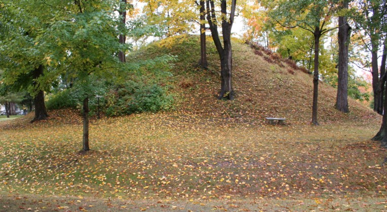 |
The GPS coordinate readings seem to zero in for latitude and longitude rather rapidly compared to the elevation result. I like to wait until I have eight differentially-corrected satellite readings, if possible. Even then, elevation will keep changing slightly, sometimes more than the stated 3D accuracy, so I'm not certain I can trust the elevation to the stated accuracy. With all the rain and clouds, and my occasional impatience in cold winds, the readings are so far averaging 4m in instrument-stated 3D accuracy. With this caveat, I report that the top of Marietta Conus is 221 m in elevation above sea level.
![]()
Marietta Quadranau
|
|
Download the 1280 x 800 pixel desk picture of this image.
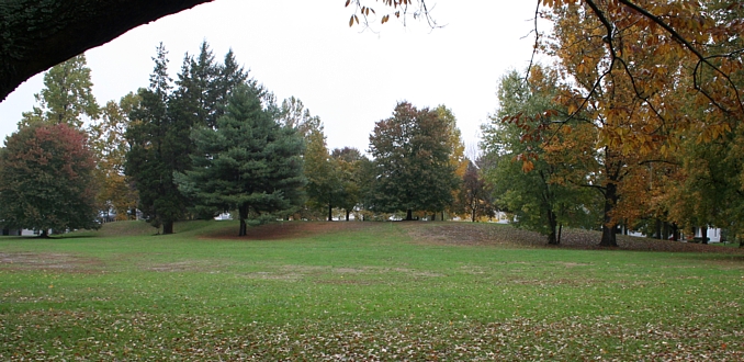
The Quadranau truncated pyramid mound and its southwestern ramp are seen amidst the trees in these two views.
 |
 |
This home on the corner of Sacra Via and Third St. faces the Quadranau. Archaeo location, archaeo location, archaeo location. As a resident of the West most of my life, I'm very impressed by the fine architecture and masonry in the East. Shelly Windeler, if this image sells the house send a share of the commission the Ohio Historical Society in my name!
![]()
Marietta Capitoleum Mound
|
|
Marietta was the first permanent settlement in the territory of the Indian Nations after the Revolutionary War. The first construct was a fort inside the square with rifle slots from which the Indians could be shot. Under British rule, it was illegal to invade the Indian Nations in the Ohio Valley. After the Revolutionary war, many soldiers were given land grants and the Ohio Valley region became the Northwest Territory of the United States, and Marietta the capital. Historians rarely write of this grievance with the Crown and consequence of the American Revolutionary War.
Now, to my editorializing about site destruction. The first residents of Marietta did preserve some of the unique works, so we have to give them some credit. They passed a resolution making the squares commons areas.
We can literally read these sites. They speak volumes, a bit of which I hope comes through in my writing. They are a codex, written on the earth. Even the context has meaning. At the Earthworks Celebration, one of the speakers was discussing the possibility that the Hopewell were addressing the moon, creating grand earthworks for their god to see, to paraphrase as best I can. I felt better when the blackboard was scratched in grade school than I felt listening to this conjecture. In my view, the monument builders are still speaking to all people for all time forward. It is we who cannot read or hear or see, who lack feeling for what the ancients have given us. Destruction of ancient monuments is no different than burning libraries. Each time another mound or ruin is destroyed, another word is erased from the grandest codex ever created, a book as large as the earth itself and intended to last for all time. Unfortunately, the builders did not foresee our modern capabilities for destruction. The destruction must STOP. The private property rights of a single individual should not supersede our collective right to possession of an incredible treasure for the ages.
This blog is falling behind my activities. Yesterday I visited Dunlap Works and Cedar Bank Works near Chillicothe. Today, I had to give my shoulders some recuperation and therapy. I'll post some Cedar Banks photos soon. It's 1 am in Chillicothe, the Hopewell heartland, and time for me to rest.
|
Continue: |
|
EDUCATORS -- Use my image
resources free and without hassle -- Permissions
|
Home | Archaeology | Astronomy | Photo Galleries | Contact and Feedback
© 2005 James Q. Jacobs. All Rights Reserved.
