| ArchaeoBlog |
|
2026.01.27 - Amazon Geoglyph surveys and resurveys kept me busy much of last summer and Southwest Loops has been my primary focus since then. These two files were just updated for the new year. After upload the KML file size, some 75,000 lines of code, caught my attention, 9,876,543 bytes:
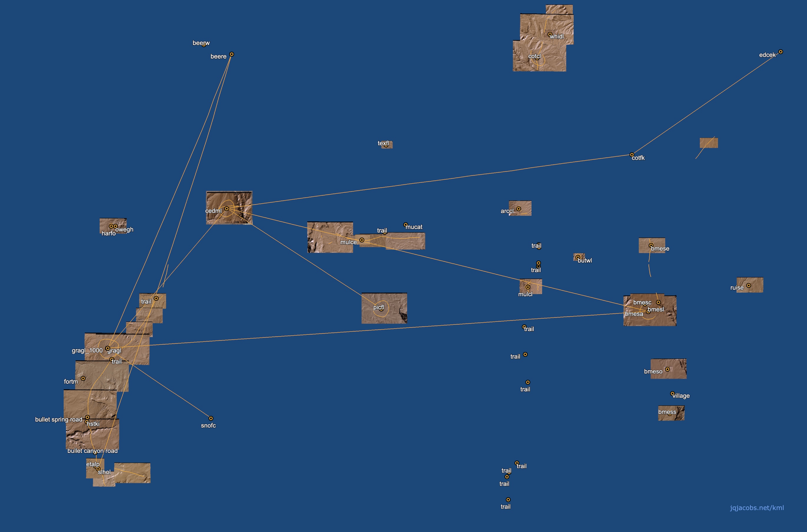
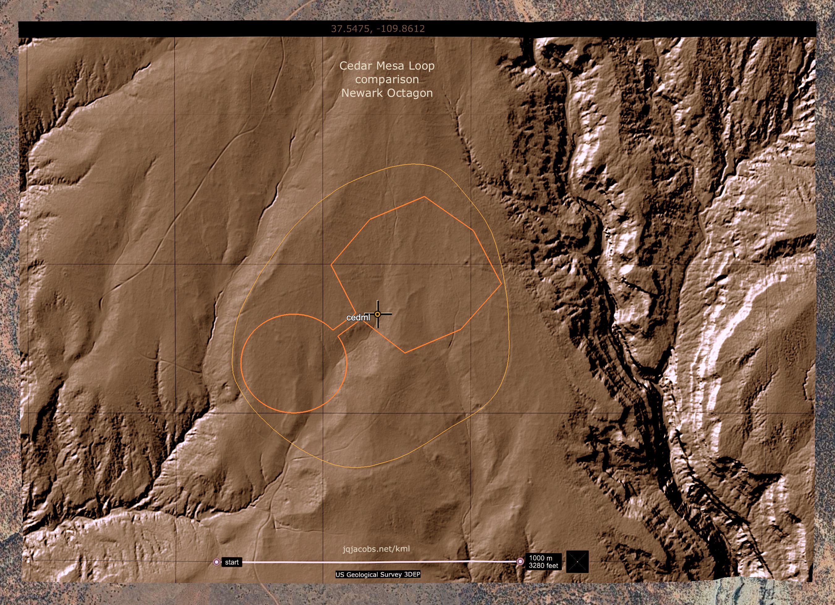
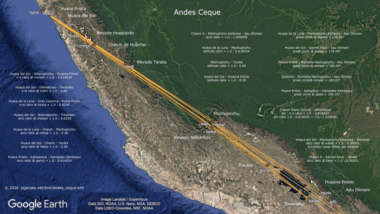
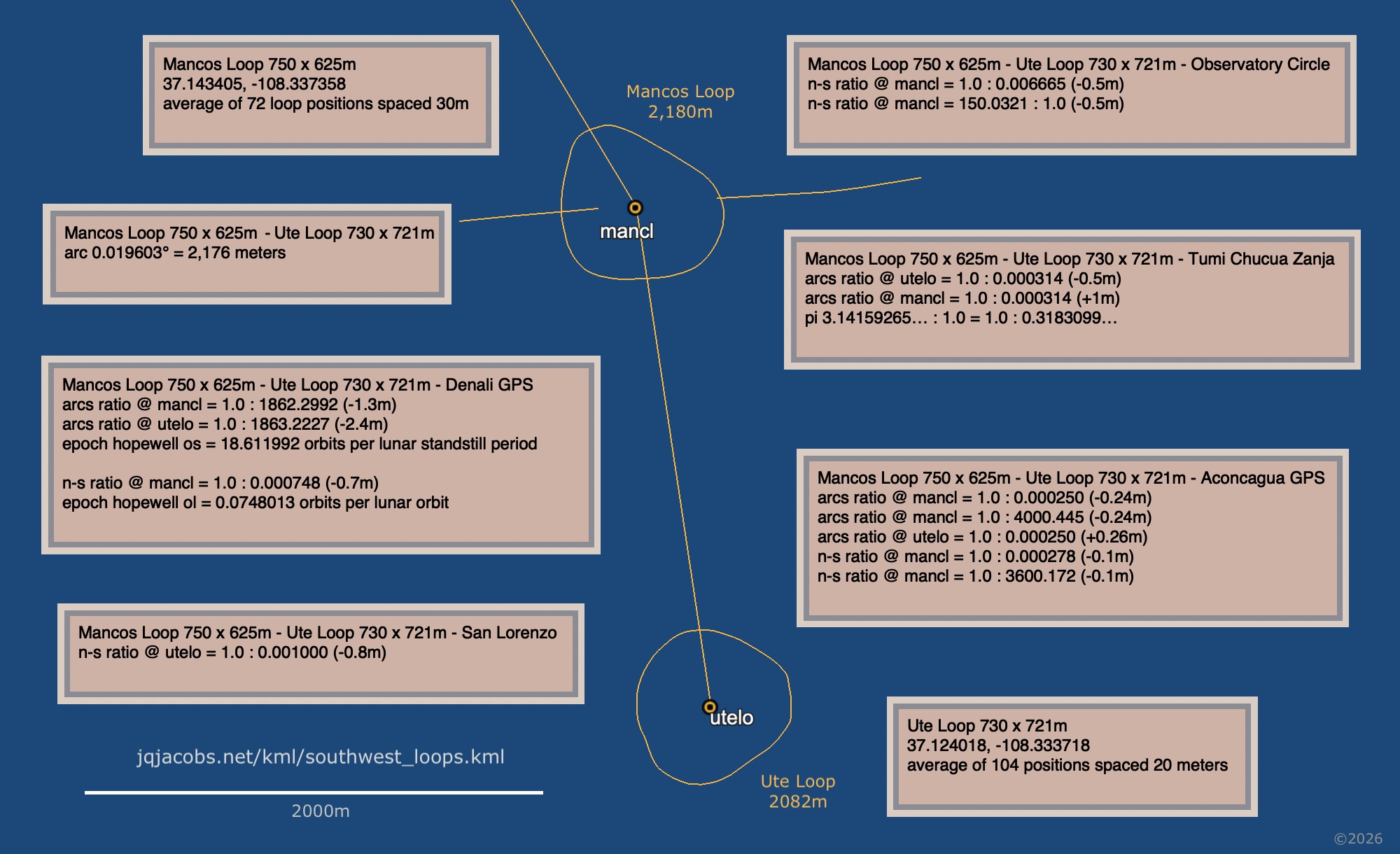
Last fall my attention not only shifted to the large earthwork monuments in the Northern San Juan region of the American Southwest, my method shifted from satellite imagery survey to lidar survey. In contrast with survey of satellite imagery in Amazonia, the USGS 3D Elevation Program (3DEP) data based on one meter resolution digital elevation modeling provides high confidence in location precision. However the ancient southwest loops, often termed loop roads, present new challenges. Unlike the deep ditches of many Amazon geoglyphs the loops were not dramatic alteration of the landscape. So today they often present as interrupted trails, segmented traces of cleared pathways which originally altered elevation only slightly. Two other factors impact my determinations of their placement in global context, their often irregular forms and the scale of the largest loops. I often use Google Earth ruler tools to determine coordinates of monuments such as circles or squares. Confidence in centerpoint determination correlates with how regular the forms are. When the form is irregular and as size increases margin of error increases. In the course of resolving site-to-site relationships of the largest loops, all irregular to some degree rather than true circles, in some cases margins of error of the results were less than the assumed margin of error of my loop centerpoint determinations. I decided to improve the methodology by averaging evenly spaced positions along the outlines of six large, sufficiently continuous loops. The updated KML includes those outlines in the methodology folder, more discussions, results edited with the revised coordinates, and new results. Some of the graphics include the initial site codes. The KML file includes numerous screensaver scale graphics, free for personal or educational uses.
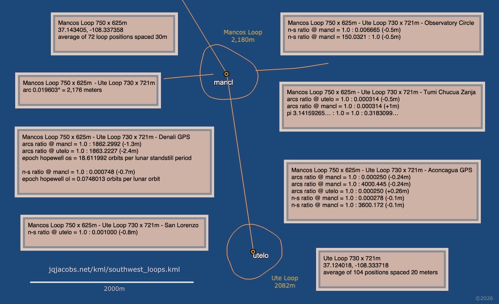
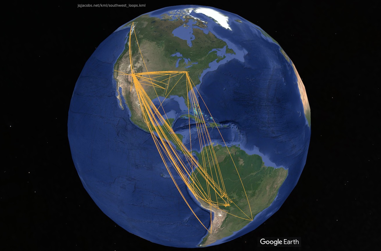
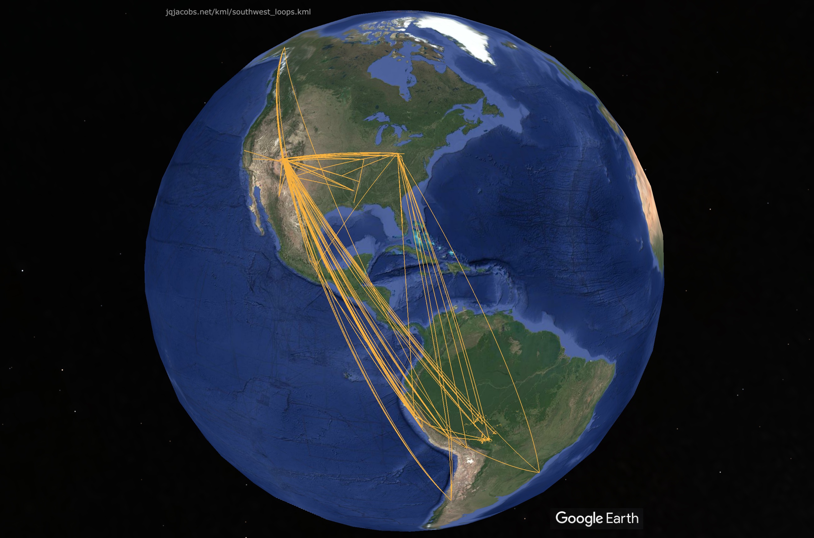
The methodology of averaging evenly spaced positions along large loops applied to loops near each other, three on Cedar Mesa and two on the Mesa Verde plateau, provides sufficient confidence in datums to examine their interrelationships. The Grand Gulch Loop 1225 x 1124m - Cedar Mesa Loop 1024 x 880m - Picket Flat Loop 975 x 888m centerpoints are spaced with an arcs ratio of 1.0 : 0.999702 (10,795m : 10,792m) at Cedar Mesa Loop. Once again, the result margin of error is less than the assumed margin of error of their coordinate determinations. Given the methodology, greater precision for this one-to-one arc distance ratio result cannot be expected. The Mancos Loop to Ute Loop arc distance (2,176 meters) matches the Mancos Loop perimeter (2,180 meters) within the expected margin of error. Applying the refined datum determination method to two such proximate loops provided sufficient confidence to examine their placement in relation to other monuments and mountains. Their center-on-center spacing is one twentieth the arc distance from Ute Loop to Aztec Hubbard Tri-Wall Kiva. The following graphic presents more Mancos Loop and Ute Loop results. This blueprint overlay is one of the placemarks in the KML. I was surprised finding larger loops than those I'd documented in 2022. Precise results for the first few relationships I checked for the largest loops with major monuments and peaks of the Americas was more expected than surprising. I expected results to include Newark Earthworks but did not expect and was surprised when the results came full circle to my 1991 finding, when I first noted the arc distance between Newark and Marietta earthworks equaled circumference of the earth divided by days per year (Newark Archaeogeodesy, Assessing Evidence of Geospatial Intelligence in the Americas). Study continues. The KML file includes more discussions. The following graphic displays the results with tessellated lines representing the selected site relationships in the KML file. As study continues I will add new results to the KML file. 2026.05.01 - Happy International Workers' Day. And Happy May Day. Look around, workers built it all.
|
 Previous Years Linked Below |
