2007 ArchaeoBlog


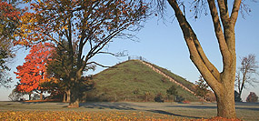
Winter Solstice and Long Barrows

2007.12.22 - Astronomy Constants and the Avebury Landscape? Perhaps. Long Stones Long Barrow, West Kennet Long Barrow, and East Kennet Long Barrow are older Neolithic structures near Avebury and Silbury Hill ... more ...

2007.12.20 - Bend of the Boyne Winter Solstice Webcast. To view the webcast go to the Heritage Ireland website. The 2007 Newgrange Winter Solstice Webcast is the first time illumination of the passage and chamber will be streamed live. A Brú na Bóinne Visitor Centre exhibition celebrates the 1967 discovery of the Winter Solstice illumination at Newgrange and will broadcast sunrises of the 21st and 22nd near 9 GMT. The event will remain available via online stream.

2007.10.04 - Google Earth updates Bend of the Boyne. The new aerial imagery is quite high resolution. Download the Google Earth placemarks file, boyne.kmz, or use the coordinates below to locate a specific monument.


2007.07.16 - Southwest Spring 2007 Travel Posts

2007.03.02 - Ancient Peruvian Astronomical Observatory at Chankillo.  

2007.01.30 - The Three Major Neolithic Complexes page has the research update:

"At Avebury, when obliquity equaled precisely 24 degrees,
the level summer solstice sunset pointed precisely to Newgrange"

2007.01.14 - The Thornborough Page is updated with a study results summary. The results caused me to contemplate a new perspective on eclipses, a heliocentric model. In the results, an eclipse related module termed S22 is prominent. S22, my AeGeo programming term for solar orbit per lunar nodal period, equals 26.820613 degrees. We think of eclipses from a geocentric perspective...

2007.01.11 - Celebrating Twenty Years of Archaeogeodesy Studies. On this date in 1987, I wrote down the quantification of the analytic modules used in my archaeogeodesy studies. These are now available as a new worksheet in archaeogeodesy.xls v2007.01.11. The update includes an eclipse calculator using Excel's vlookup function, so you only input the terse AeGeo code terms to do calculations.


2006.11.27 - Big News: Cuzco imagery has updated in Google Earth™ (GE). I've anxiously awaited these new aerial photos. Recent ArchaeoBlog entries related to GE placemarks have moved to a new page, ../blog/placemarks.html, and I continue the Cuzco placemarks discussion thread there, with some early results reported also.

2006.11.14 - Time flies. The first transparencies used on this domain were scanned beginning a decade ago, at 675 dpi with a Polaroid SprintScan 35 slide scanner. I just re-scanned some images for the Machu Picchu Photo Gallery, the most visited photo page. Meanwhile, other recent scans were languishing offline. Image updates in the last week also include Teotihuacan ruins and mural art. Others updates will follow as time permits. Some days, a photo stock request determines which site is scanned next, so updates gets sprinkled all about: Betatakin, Vernal Rock Art.

2006.06 - Ancient Earthworks of the Eastern Woodlands


More:

ArchaeoBlog
An archaeology web log by James Q. Jacobs

2023 -  2022 -  2021 -  2020 -  2019 -  2018 -  2017 -  2016 -  2015 - 
2014 -  2013 -  2012 -  2011 -  2010 -  2009 -  2008

betatakin ruin deskpicture link
Southwest Spring 2007 Travel Posts

The Original ArchaeoBlog Pages, Fall 2005:
Mound Builders of the Eastern Woodlands

miamisburg mound


EDUCATORS: Use my images free and without hassle - Permissions
Home  |   Archaeology  |   Astronomy  |   Photo Galleries  |   Contact and Feedback

"Antiquity willfully veils the truth so that the fool will go astray and only the wise may know." 
Phaedrus, writer of fables, writing in Rome.

 © 2011 by James Q. Jacobs. All Rights Reserved.
Follow me on Twitter.