|

Space Archaeology in the Amazon, Beni, Bolivia
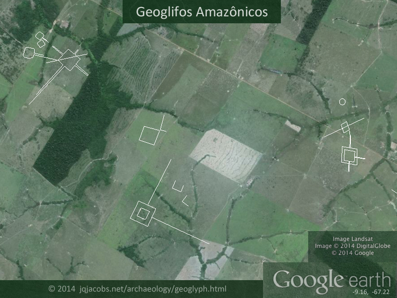
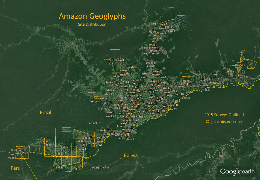
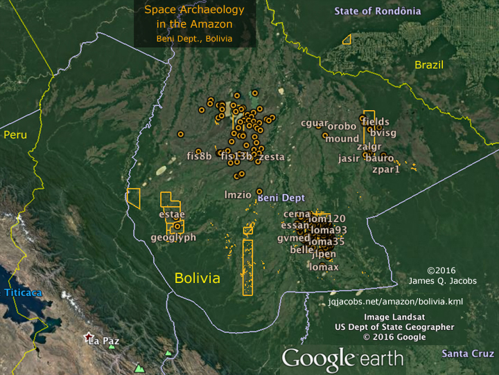
2017.02.07 - After catching up the Amazon Geoglyphs survey, I turned to the adjacent area to the south in Bolivia. Several areas with newly updated hi-res imagery in Google Earth had dense prehistoric occupation with earth moving cultural expressions. This Amazonian region, a vast, seasonally flooded savannah known as Llanos de Mojos, is particularly rich in archaeology. Elaborate causeway and canal networks and extensive raised agricultural fields are visible along with geometric earthworks and mounds. Survey results are placemarked in a new Google Earth KML file:
Space archaeology has become easier over the last decade as more high resolution imagery is published. I can't keep up, but I'll keep trying. Already, more areas in Bolivia are updated and many more earthworks are visible, so I'll update this file later. Check the ArchaeoBlog for the latest news. Meanwhile, in the bolivia.kml zero in on the immense zanjas in southeast Mojos and their lunar major alignment.
Updates - Atualizaçãos
2019.01.31 - Currently, more than 500 geoglyphs are documented in both an Excel spreadsheet and Google Earth placemark files. The geoglyphs are placemarked, all except the smallest earthworks are outlined, plus visible ancient lines are highlighted.
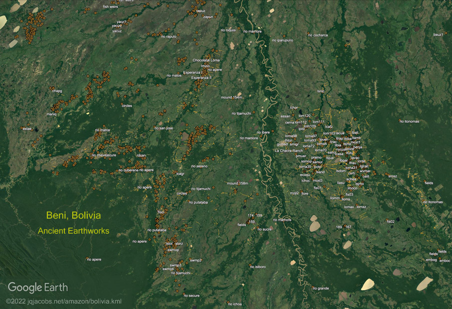
2021.12.30 - Currently, I have placemarked and databased more than 1,100 ancient Amazonian earthworks, with over 1,050 geoglyphs and zanjas plus over 50 mound villages documented in both the Excel file and the KML placemarks file linked above. Almost all earthworks are outlined, along with highlighting of 1,000 lines, visible ancient roads and embankments. I've also added, to improve viewing the outlines and lines and to facilitate creating graphics, background overlay images with three color options, black, blueprint, and jungle green.

This first major update after nearly three years more than doubles the number of sites since then. In the past three years Google Earth satellite imagery updated in many areas and I began using other satellite image providers, especially for those areas still having poor resolution in Google Earth. I patiently waited ten years and relented to doing the extra work involved. Viewing more satellite images augments and upgrades the data, justifying the effort. I updated numerous coordinates, outlines, and lines, and added graphics, more research results, and academically published site names.
Some of the geoglyph placemark balloons now feature quotations with links to their sources, thus geolocating selected information. Below in this page the references table is updated and the table is also in a folder in the KML file.
2022.04.26 - Since the Dec. 30 update, I've researched local naming of sites and aerial photography. Several geoglyphs not easily spotted in satellite images were revealed. More geoglyphs are placemarked and outlined and more geoglyph placemark balloons feature referenced information and published locality names. Herein and in pertinent placemark balloons I've added more information about the history of discovery of the geoglyphs, a few more references, plus links to selected aerial photography. Both the KML and XLS files are updated.
2022.07.06 - Following on the Nature article of new LiDAR surveys in Llanos de Mojos, I decided to update the Beni, Bolivia KML. Surveying the past six years of Google Earth hi-res updates in the region added over 3,500 placemarks, doubling the number of visible earthworks.
View larger image - download 2.7 MB KML file - jqjacobs.net/amazon/bolivia.kml
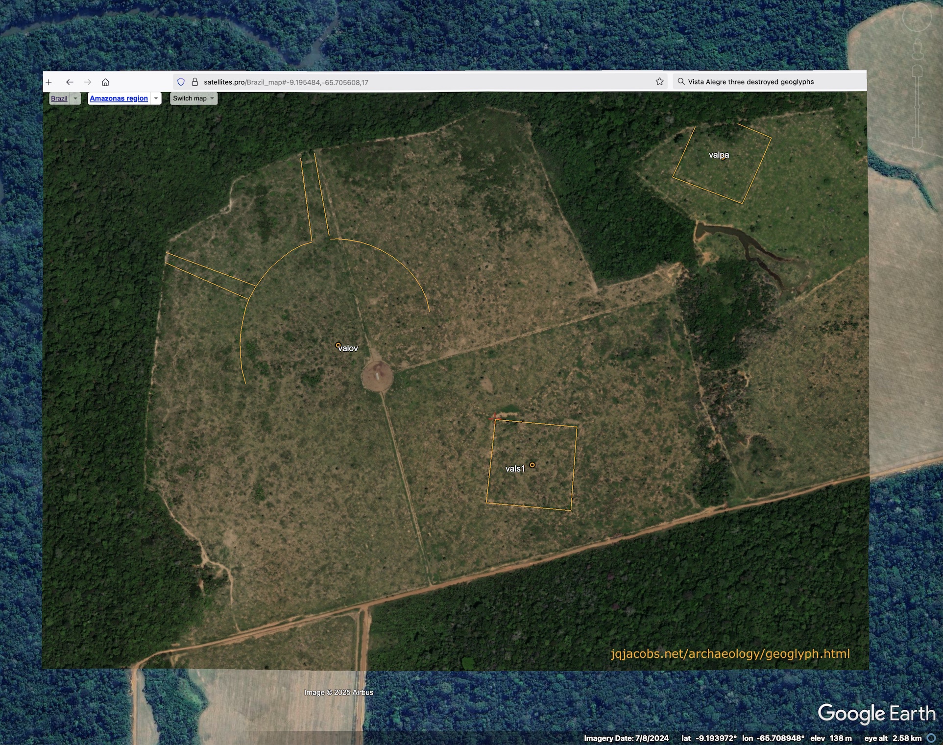
2023.02.04 - One satellite image update in particular in Acrelandia clearly illustrates how different aerial satellite images produce different survey results and how important it is to examine as many satellite images as possible. The recent imagery updates also illustrate the optimal time in the annual vegetation and grazing cycle for satellite imagery to reveal the ancient earthworks and overcome a limitation of space archaeology in verdant regions. At the end of July the pastures are closely grazed and dry season vegetation variation is on display. Contrastingly, the nearby update with June 20, 2022 imagery around Placido de Castro did not reveal more than previous surveys. The new ../acrelandia_2022_survey.kml placemarks file illustrates how many additional earthworks were revealed in the survey area, perhaps better stated as revealing how many may remain hidden in so many other satellite images, the reason I am making this point and providing the KML. We will know the full extent of the archaeology once the region has complete lidar surveying, given of course, if the evidence is not plowed away. Too often resurvey also reveals illegal earthwork destruction in recent years.
2024.01.16 - Currently, more than 1,150 geoglyphs and zanjas, plus 60 mound villages are documented in both the Excel file and the KML placemarks file linked above. Both satellite imagery updates and recent publication of several databases contributed to the additions. One of the most significant additions in the last year is about forty aerial images of geoglyphs taken by Dr. Rob Walker using a drone. To sort to these placemarks and others with academic citations which geolocate research take note in the Google Earth Places menu of the balloons with background color.

Photo credit: Dr. Robert S. Walker
The KML file contains a surveys folder with subfolders sorted by years including 2024. I've also done some resurvey of newer satellite imagery from diverse providers in areas where Google Earth has yet to provide high resolution imagery. In Google Earth, opening the Historical Imagery tool may result in display of more recent imagery than the default display, albeit the most recent imagery may include clouds. Also, zooming in close can alter which imagery displays. Current centerpoints and outlines may reflect more recent imagery than the default display.
As the resolution of available satellite imagery improves, resurvey reveals and documents more geoglyphs and zanjas, albeit in some areas the returns are minimal for the amount of work involved. At the same time I am able to update placements and improve outlines so I continue to resurvey. The Excel file 'versions' worksheet is the best resouce to determine if you have the most recent updates. The source columns in the dataset worksheets reflect if an entry has been recently added as well as if updated with refined coordinates. Areas of low resolution imagery in Google Earth may reflect other sources.
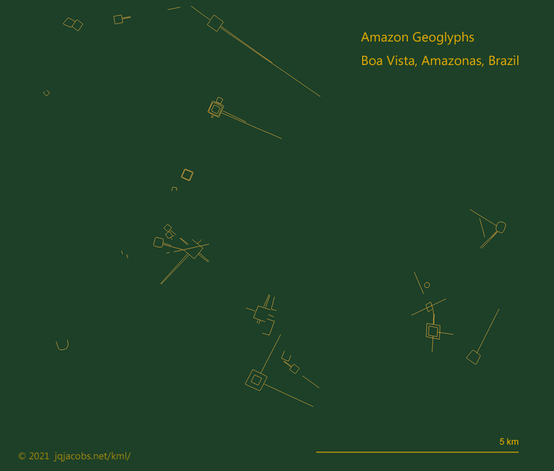
2024.10.19 - Happy International Archaeology Day - Now 1,370 geoglyphs and 83 mound villages documented after recent satellite imagery updates and a dataset release by Risto Kalliola and Martti Pärssinen. New 2024 aerial photos by Dr. Walker are embedded in the KML placemarks. Recent deforestation revealed another octagon, now named Amazonas Octagon, of the same size as the destroyed and recently replowed Acre Octagon. Both express phi relationships to Newark Octagon in Ohio, as discussed in Newark Archaeogeodesy and in the updated Octagons KML file.

view full size
| 


