Chaco Canyon National Historical Park, Photo Galleries

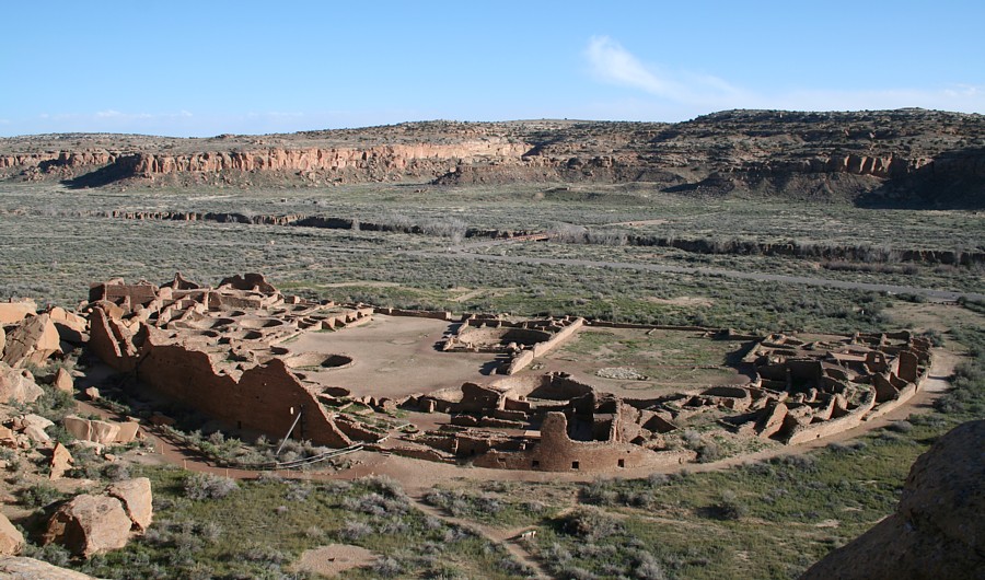
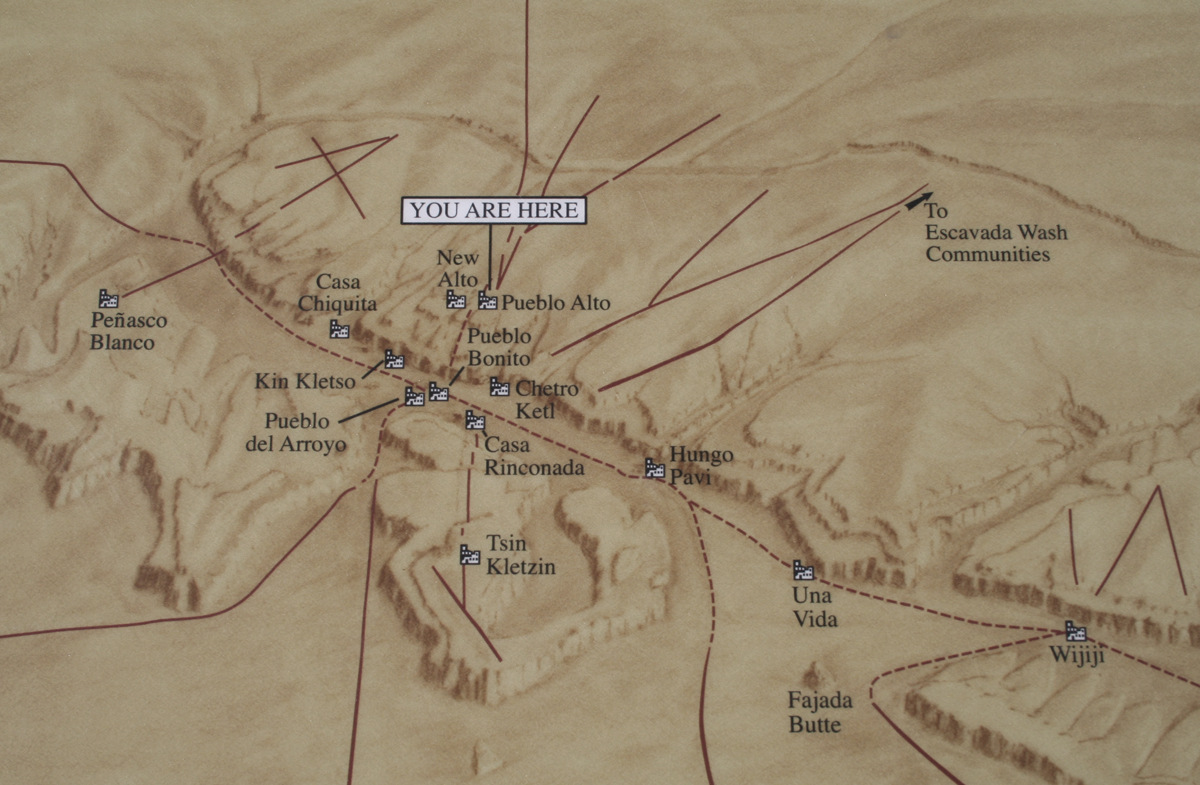
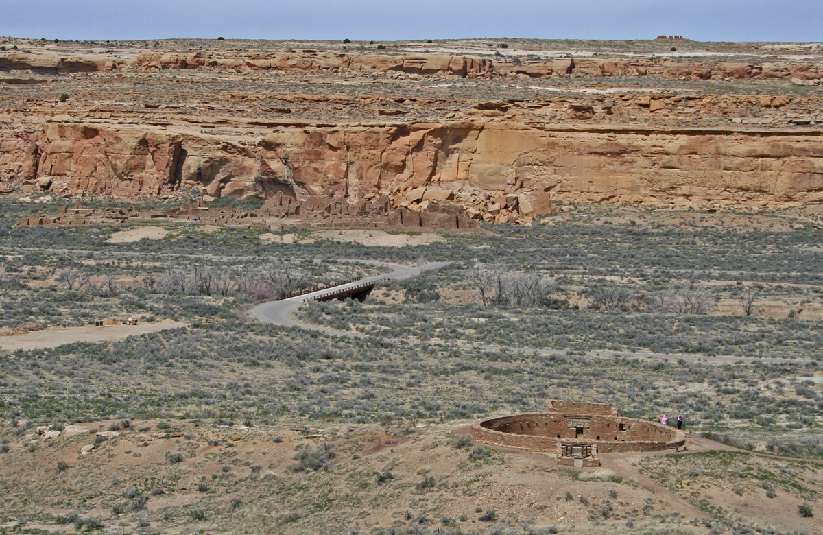
Chaco Culture National Historical Park in northwestern New Mexico contains a dozen Great Houses, large multi-room masonry constructs.  The Chaco Canyon structures were built between 850 and 1150.

More Chaco photo galleries in addition to this page:
Pueblo Bonito
Chetro Ketl
Casa Rinconada
Pueblo del Arroyo
Peñasco Blanco
Tsin Kletso
Pueblo Pintado
Pueblo Alto
Kin Kletso

Chaco Canyon Great Houses movie
1280 pixel HD QuickTime - 282 MB

Of the Great Houses in Chaco Canyon, D-shaped Pueblo Bonito, possibly five stories tall along the outer arc, has the greatest number of rooms, estimated at 650. This view is from the mesa to the North of the ruin. The center wall aligns to true North and half of the south wall aligns due east-west.
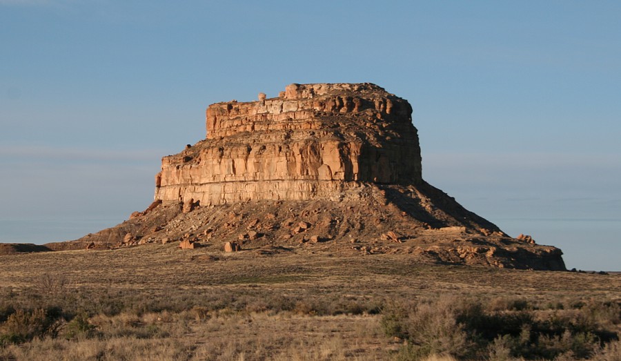
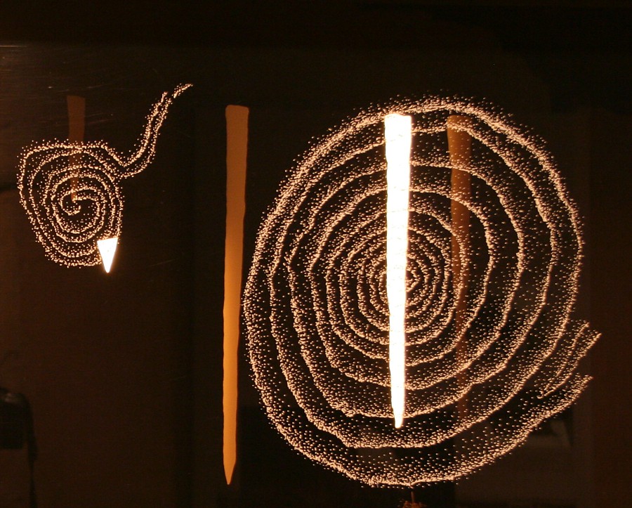
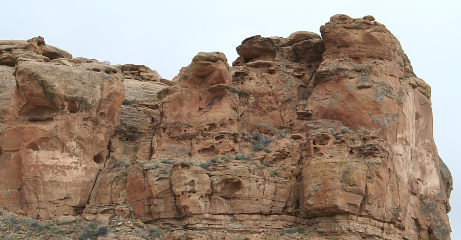
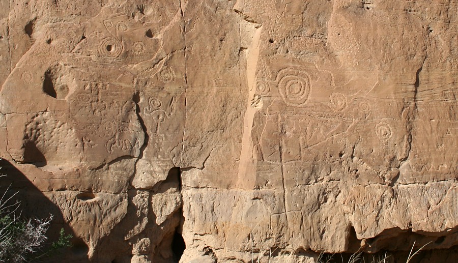
pueblo bonito in chaco canyon

Click images for larger views.

fajada butte, chaco canyon

Fajada Butte is noted for the Sun Dagger hierophany, a petroglyph spiral behind slabs of rock which framed zenith passage sun and moon light as a unique, complex seasonal calendar. Below, an interactive display at Maxwell Museum, University of New Mexico, displays the change in illumination for each season. The slabs at the site recently shifted, likely studied to death!

Fajada Butte Sun Dagger Hierophany

chaco canyon map of great houses
Great Houses and Chaco roads in and around Chaco Canyon.

great house masonry in Chaco Canyon

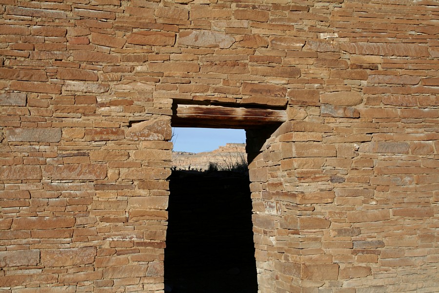
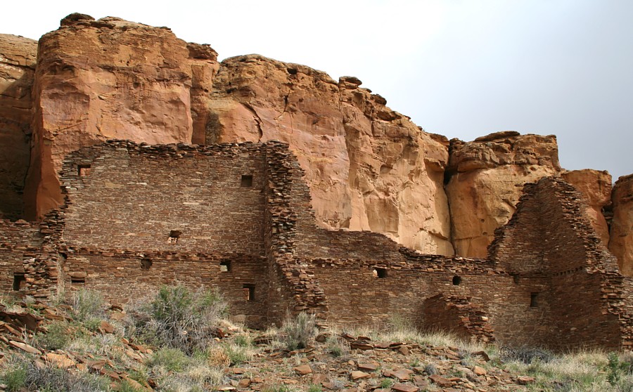
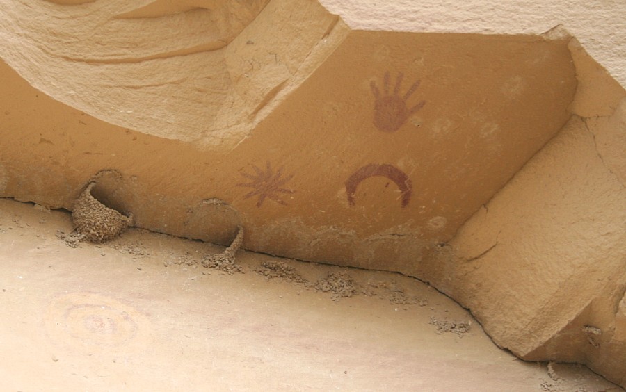
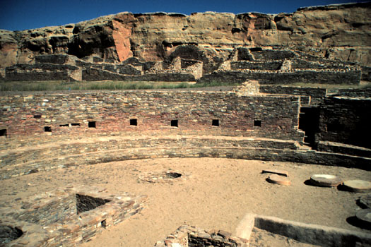
The style of masonry varies at the various great houses in Chaco Canyon.  All the masonry is of high quality.  Nonetheless, the beautiful artistry was covered with stucco and probably painted.  It is all the more impressive for having survived for 1,000 years in an exposed area.

Una Vida pueblo viewing south across Chaco Wash.

Hungo Pavi Great House ruins
Hungo Pavi Great House ruins (above) and New Alto ruins (below).
New Alto ruins

Casa Rinconada in the foreground, Pueblo Bonito across Chaco Wash, and Nuevo Alto on the horizon.

Chacoan stairway cut into this cliff, left of center, connected the wash area  across from Chetro Ketl with the Tsin Kletso mesa
Chacoan stairway cut into this cliff, left of center, connected the wash area
across from Chetro Ketl with the Tsin Kletso mesa. Click images for larger files.

Pictographs hypothesized as a depiction of the 1054 supernova.
Pictographs once hypothesized as a depiction of the 1054 supernova. Note lower-left.

chaco canyon pottery
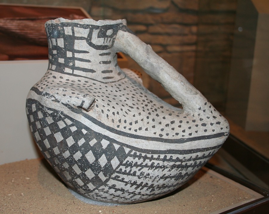
The Visitor's Center features a museum with Chacoan artifacts, a bookstore, and a theatre.

Chaco Canyon stone circle

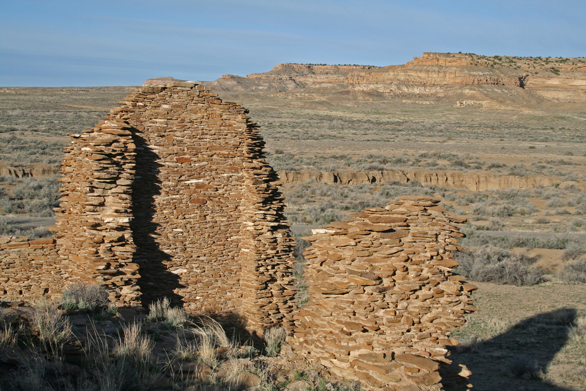
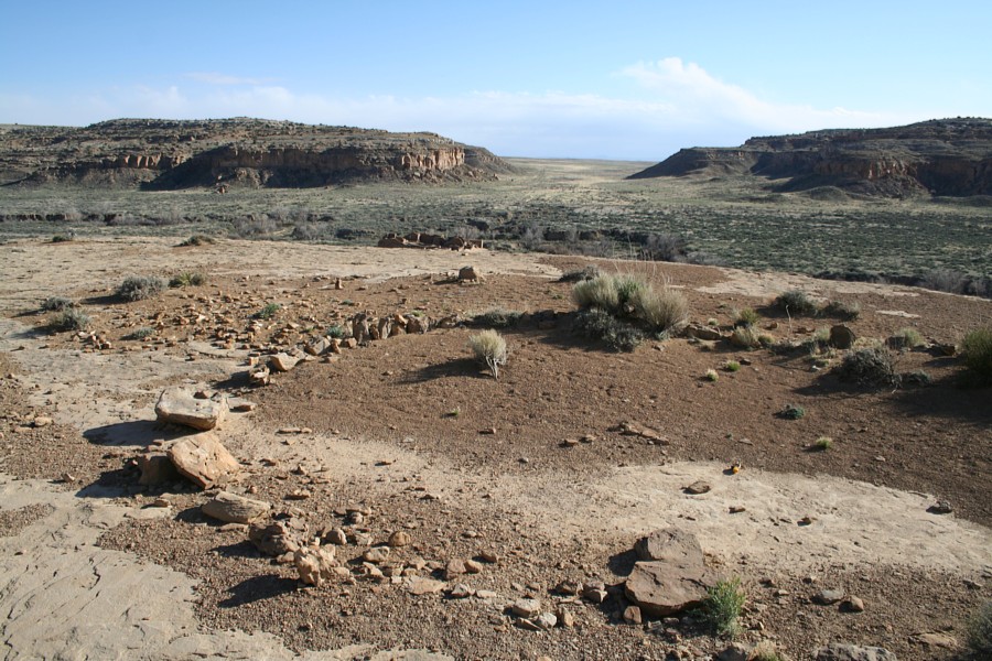
View from north mesa at the Stone Circle, Pueblo del Arroya is visible near the wash.  One of the ancient Chacoan Roads, South Gap Road passes through South Gap in the distance.

After Chaco Canyon was abandoned the most important site in the San Juan Basin was Aztec Ruins.  Later in the sequence Casas Grandes replaced Aztec as the largest center.  Chaco Canyon's great houses, the various ruins at Aztec and Casas Grandes are aligned on a north-south meridian.  After discovering this alignment in 1990, I named it the "Chaco Meridian" in 1991.  Also on the Chaco Meridian is one of the highest prominences of the Rocky Mountains, Mount Wilson and Wilson Peak.  Pueblo Bonito and Chetro Ketl are situated at precisely 1/200 of circumference from Wilson Peak.

petroglyphs in chacvo canyon

double rainbow in new mexico near chaco canyon
A rare rainfall on the drive into Chaco Canyon.

Chaco Canyon Photo Galleries
Pueblo Bonito
Chetro Ketl
Casa Rinconada
Pueblo del Arroyo
Peñasco Blanco
Tsin Kletso
Pueblo Pintado
Pueblo Alto
Kin Kletso

Google Earth Placemark Files
Chaco Canyon
Mesa Verde
Hovenweep NM
Aztec Ruins
Arizona
Salinas
Utah Ruins
Colorado Ruins
Ancient Monuments Placemarks

Photo Gallery PowerPoints
Aztec Ruins
Chaco Culture NHP
Pueblo Bonito
Mesa Verde
Edge of the Cedars
Gran Quivira
Maxwell Museum
Coronado State Monument
Quarai
Pecos Pueblo
Anasazi Heritage Center
Abó Mission
Links
Spring 2007 ArchaeoBlog   |   Rock Art Pages  
  
submit to reddit
MySpace


External Links


Next on the Southwest Web Ring:

The Chaco Meridian

SOUTHWEST PHOTO GALLERIES
Mesa Verde National Park
Spruce Tree House
Canyon de Chelly
Chaco Culture National Historical Park
Aztec Ruins
Salmon Ruins
Hovenweep National Monument
Trail of the Ancients
Betatakin
Pecos National Historical Park
Canyons of the Ancients
Edge of the Cedars
Coronado State Monument
Bandelier National Monument
Blythe Intaglios
Salinas Pueblo Missions
Montezuma Castle
Museums
SOUTHWEST ARTICLES
Water Politics and the History of
the Fort McDowell Indian Community
Social Organization of
Three Apache Tribes
A History of Havasupai
Political Organization
Diabetes: Thrifty Genotype
or Thrifty Phenotype?
Southwest Archaeology
Lecture Notes
Pueblo Grande Mound
A Labor Analysis
Rattlesnakes of Arizona
The Chaco Meridian
Besh-Ba-Gowah


WORLD WIDE WEB HUBS BY THE AUTHOR:
Home - Photo Galleries - Archaeology - Andes - Moundbuilders - Astronomy - Art - Web Design

Southwest Anthropology and Archaeology Pages
© 2014 by James Q. Jacobs.  All rights reserved.  Photo Stock.
Your comments, inquiries, etc. welcomed.  Contact and Educator Permissions.