| Liberty Township Earthwork and High Bank Octagon Earthwork |
Liberty Works
 |
"This work is a fair type of a singular
series occurring in the Scioto valley,-all of which have
the same figures in combination, although occupying different
positions with respect to each other, viz a square and
two circles. These figures are not only accurate squares and
perfect circles, but are in most cases of corresponding
dimensions,- that is to say, the sides of each of the squares
are each ten hundred and eighty feet in length; and the diameter
of each of the large and small circles, a fraction over seventeen
hundred and eight hundred feet respectively... It will
be observed, that while the wall of the larger circle is interrupted
by numerous narrow gateways, that of the smaller one is
entire throughout,-a feature for which it is, of course, impossible
to assign a reason, ... The whole work appears to have
been partly finished, or constructed in great haste ... No
one would be apt to ascribe a defensive origin to this work,
yet it is diffcult to conceive for what other purpose a
structure of such dimensions, embracing nearly one hundred
acres, could have been designed," - Squier and Davis,
56. |
"It is not to be supposed that these numerous coincidences are the result of accident." - Squier and Davis, 71.
Ancient Monuments Placemarks - Liberty Works and High Bank kmz files with map overlays.
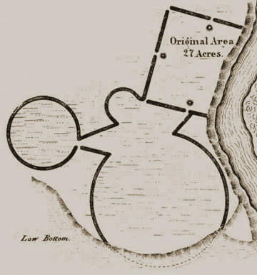
Mills writes of Squier and Davis, continuing after citing also the quotes above, "In another place, after describing the many striking resemblances in area and other properties to be observed in the works at Newark, Hopetown, High Bank, and Marietta, they say
" It can not be too often or too strongly impressed on the reader that these "coincidences," so often given and referred to in their text, have no existence in the works themselves, The larger circle of this group is plowed level, and no measurements could be obtained, The square is nearly obliterated, making any estimate of its angles or dimensions unsafe; but it appears to vary considerably from "accuracy."
The smaller circle, however, is all in woodland or pasture, and could be surveyed without difficulty. Under the impression that this was the hypothetical figure given by Squire and Davis (see page 56) as absolute proof of the uniformity of curve, especial care was taken in its measurements.
"The diameter, it is true, is given in their plate as 800 feet, while the supposed "perfect circle" had, according to their text, a circumference of 3,600 feet; or, as it was platted, circumscribed a dodecagon of 3,600 feet perimeter. It was evident from this that an error existed somewhere, which we hoped to locate...."
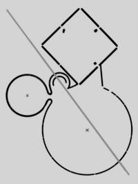
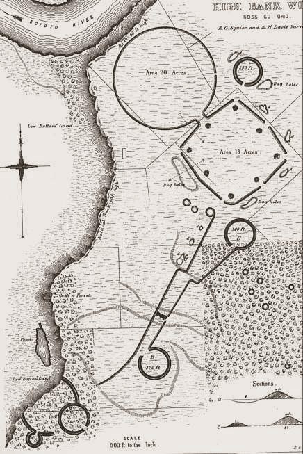
Portion of Squier and Davis 1847 drawing of |
"Stakes were set 100 feet apart along the middle line of the embankment, beginning at the south side of the gateway. The bearing of each stake was then taken from the one next preceding. Had the curve been regular, as claimed by the authors, each angle of divergence, to the last one, would have been the same. Instead of that, they read as follows: 21°35'; 3°09'; ..... twenty-two full chains, making 2200 feet. The last ... was thirty feet, making the angle of divergence much smaller than it would have been with a full chord, The wall terminated abruptly at station 1; as this portion is in land on which the original timber is standing, there can be no presumption that it ever extended farther, although in the original survey it is represented as reaching in an unbroken line to the gateway or opening and thence to the larger circle; as shown by the dotted lines in figure 26. From station 1 to station 24 the distance is 343 feet, making the entire circuit, by this system of short chords, 2,543 feet. Measured exactly on the circle, with allowance for curvature, this figure would have been slightly larger, It is only thirty feet in excess of the circumference of a true circle with a diameter of 800 feet; which goes to show that Squier and Davis merely ran a line around the embankment, called the work a "perfect circle," and made the diameter 800 feet for even figures. " |
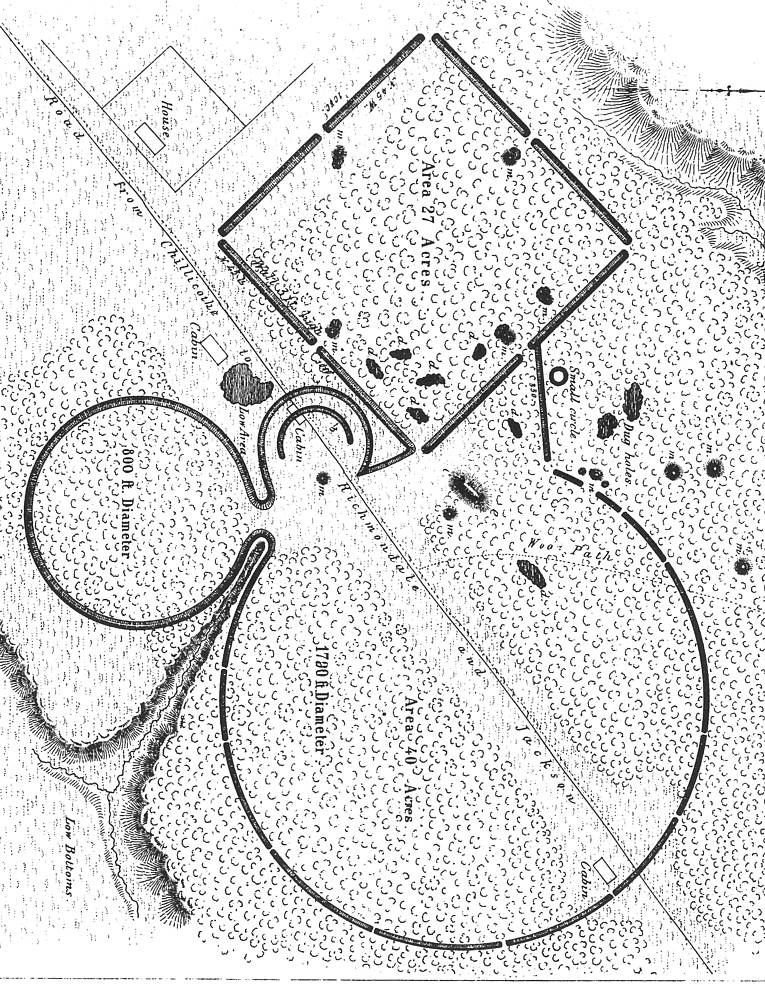
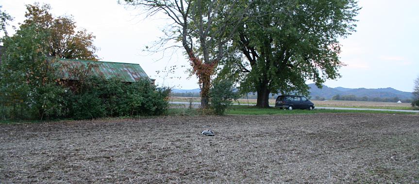
| Image right. Location of Harnass Mound and Liberty Earthwork is not readily discernable in the agricutural fields and yards covering the area today. Railroad tracks were laid through the square and circle, near parallel to the road. |
|
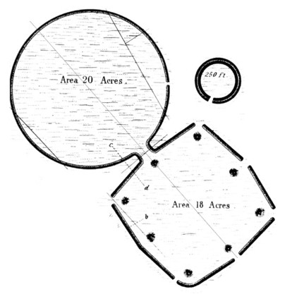
Right. High Bank Octagon and Circle, part of the drawing by Squier and Davis. "The circular enclosure is almost geometrical in its accuracy; a radius of 526 feet will describe a circle which will nowhere miss the middle line of the embankment more than six feet. " Regarding the Octagon Thomas writes, "...this inclosure is comparatively regular, the oposite angles, with one exception, differing less than half a degree ... the regularity is not such as would be expected from the use of instruments." |
|
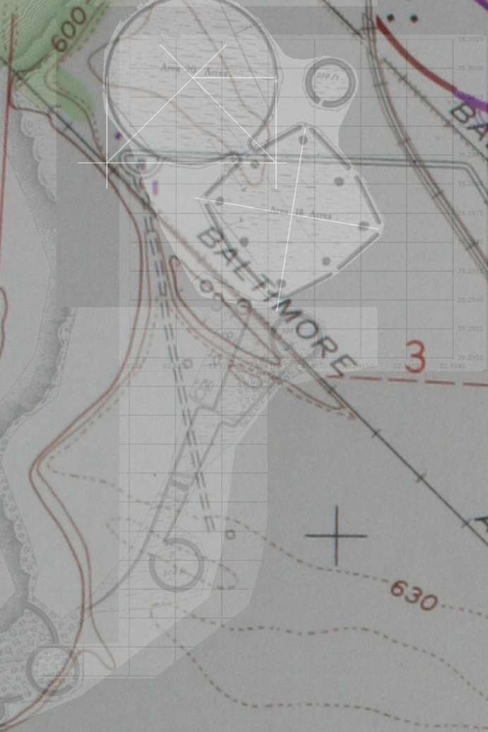 |
Topographic map, Squier and Davis drawing, and a chart of GPS readings are overlain to present the location of High Bank Earthworks. The Octagon image was positioned using a still-visible corner. The adjoined octagon and circle were rotated to match the azimuth survey data by Thomas. The extended work of linear embankments and circles, running south-southwestward from the octagon corner, were further rotated to fit the terrace better, so their locations are approximate. This is the entire work as depicted by Squier and Davis, and while their work is invaluable, their depictions of scale, relationships, and orientations are not all entirely precise representations, as Thomas noted in the quotes above. I used three GPS readings to locate the coordinate
grid on the topography, including an octagon corner, a road
with octagon intersection, and the road with railroad track
intersection. Centerpoint coordinates (below) locating the
octagon and circle were scaled from the grid. Liberty, High
Bank and |
Thomas writes: " The irregularity at the southern corner is due to a depression which would interfere with easy approach, The opposite sides and angles are tolerably regular. One diameter is 1,008 feet, the other 1,005 feet; the included area is 20.6 acres, It is possible Squier and Davis measured entirely within the walls; but in the adjoining circle their figures plainly refer to the top of the embankment.
"The circular enclosure is almost geometrical in its accuracy; a radius of 526 feet will describe a circle which will nowhere miss the middle line of the embankment more than six feet."
| High Banks Work | 2147.2 feet long | Marshall 1987 |
The Year 2004 Field Season at the High Bank Earthwork.
Now-obliterated Works East, known from the drawing by Squier and Davis, was situated
on the opposite side of the Scioto River upstream and north of High Banks and Liberty Earthworks.