|
Newark Octagon Work, Newark, Ohio |
Octagon Earthworks State Memorial is currently leased to a golf club.
Newark Octagon, Newark Earthworks, Newark, Ohio
One of the most significant traces of ancient
civilization in Eastern North America is the
complex array of geometric works arrayed on the earth, the greatest
concentration of which covered
several square miles at Newark, Ohio. The Newark Octagon, the most
northwestern of the earthworks
at Newark is the largest of all geometric earthworks. The contiguous
earthwork of Observatory Mound,
Observatory Circle, the parallel embankments, and the Octagon combine
to extend 2,898 feet.
Ancient Monuments Placemarks - Newark Octagon - Newark Circle kmz files with map overlays.
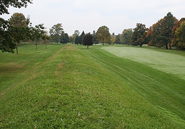
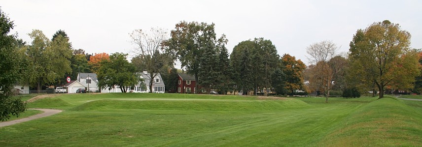
Above. One of the Newark Octagon embankments
and an opening mound in the far left. Each of the eight
vertices has a mound. Below. A surviving small circle, adjacent
southeast of the Octagon, is now a golf green.
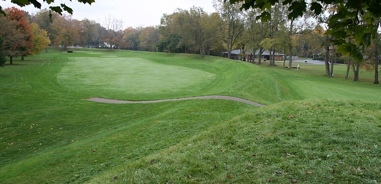
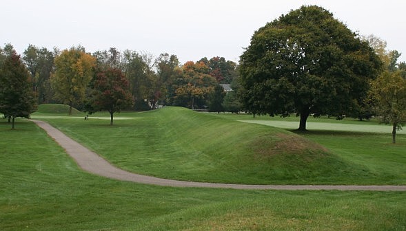
Above and below. The arcs of Observatory Circle viewed from Observatory Mound,
above from near the mound center, and below from the southeast end of linear Observatory Mound.
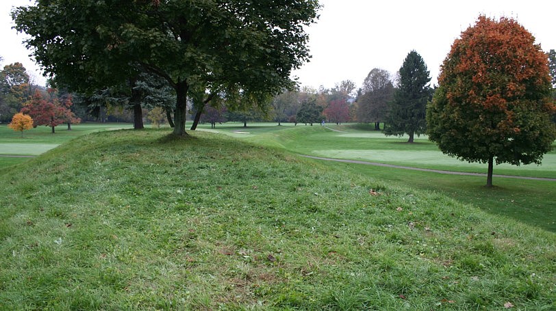
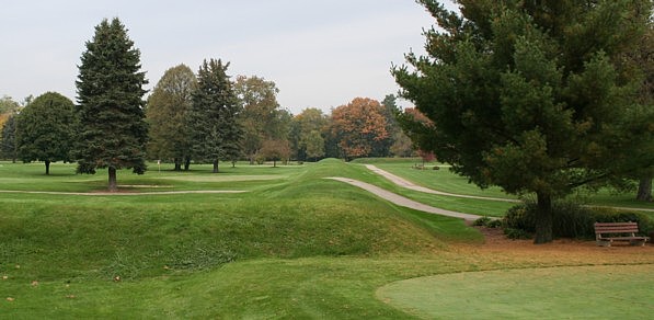
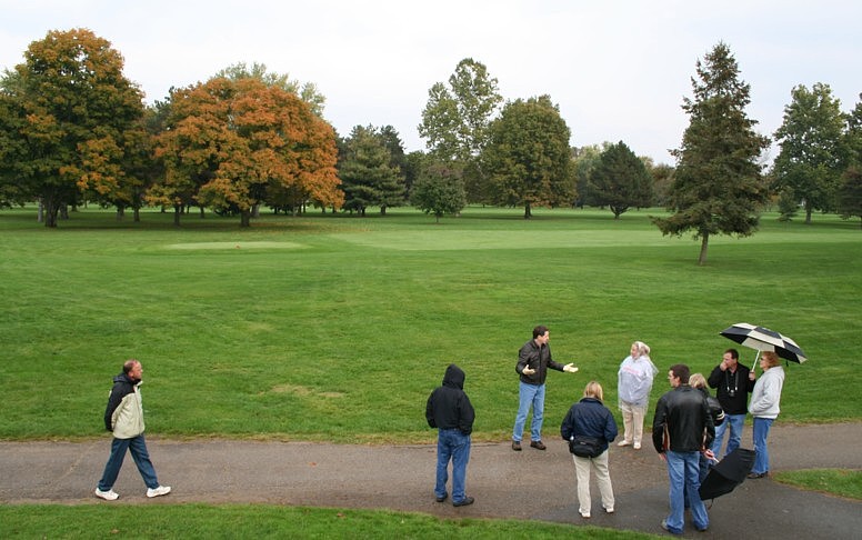
Above. From near Observatory Circle's center,
viewing the parallels and a mound in the Octagon.
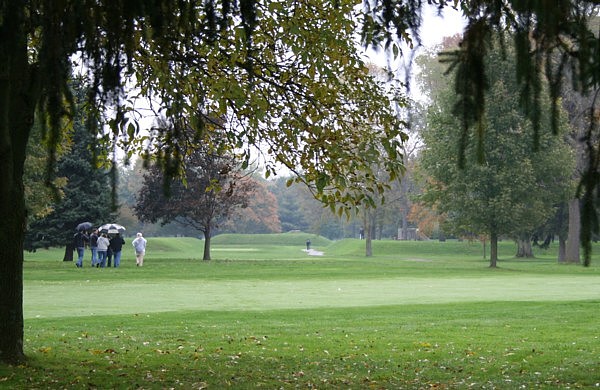
Below. The
Octagon from the mound seen above, with Dr. Bradley Lepper leading a site tour.
Excerpts from my 2001 paper Possible
Geodetic Properties and Relationships of
Some Monumental Earthworks in the Middle Ohio Valley, A Preliminary
Inquiry.
The relationships between Newark Earthworks and Marietta Square and the orientations and relationships of the various monuments of Newark Earthworks offer the best evidence of knowledge and practice of geodesy. The Newark Octagon and Marietta Square ratio of arc distance to longitude difference, the azimuth of the Newark Octagon, and the bearings between Newark Circle and the Octagon Circle infer precise understanding of the mathematical ratio of latitude to longitude. The precise commensuration of the Newark to Marietta arc distance and their longitude difference with the SO module (earth’s angular orbital motion per day) infers a precise understanding of astronomic constants and the scale of the earth. The redundancy of expression of the same relationships makes it very difficult to discount the relationships as coincidental. ... The fact that the largest of the monuments express these geodetic relationships also argues against coincidence. Given the distances involved, creating the relationships between the Middle Ohio monuments could have been accomplished using direct surveying and mathematics, and thus does not necessarily infer an astronomical method of the determination of longitude. If the Newark to Fort Center relationships are intentional, use of an astronomical method for determination of longitude is also inferred.
I conclude that the builders of the Middle Ohio earthworks understood aspects of geodesy, including accurate astronomical knowledge, knowledge of the scale and shape of the earth, knowledge of their location on the earth, and how to place find and point position.
The alignment of the Octagon earthwork nearly corresponds to the northerly lunar major extrema rise/set azimuth. According to Thomas (1894), the Octagon's azimuth is 52.15° E. of N. Further discussion of possible reasons for the orientation of the Octagon is found in the Temporal Epoch Calculations page.
Newark Octagon to Marietta Capitolium Mound, arc distance =
CIR / 365.0
Newark Octagon to Marietta Capitolium Mound, longitude difference = CIR
/ 365.0
Newark Octagon to Marietta Quadranau Mound, arc distance = CIR / 366.0
Lunar orbits per rotation = 0.036501
Lunar orbits per day = 0.036601
Newark Observatory Mound to Newark Octagon Center = 0.000100 radians
Newark Observatory Circle to Fort Center Circle = 0.0365016 CIR
The great circles at Newark align to Marietta Earthworks.
MORE: Newark
Archaeogeodesy
Assessing Evidence of Geospatial Intelligence in
the Americas
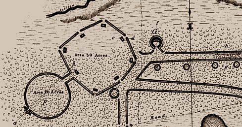
| Code | Location | Latitude | Longitude | Source | |
| fcci | Fort Center Circle | 26.9546593 | -81.1656965 | map | 1:24,000 |
| fcmo | Fort Center Mound | 26.955034 | -81.1626328 | map | 1:24,000 |
| nocc | Newark Observatory Circle | 40.05207671 | -82.44861007 | GPS | derived 3 |
| noom | Newark Observatory Mound | 40.05113889 | -82.45013889 | GPS | 5m |
| nocp | Newark Octagon Center | 40.05469583 | -82.4442625 | GPS | derived 9 |
| noa | Newark Octagon Entrance | 40.05345556 | -82.44632222 | GPS | derived 4 |
| nocg | Observatory Circle Gateway | 40.05297222 | -82.447125 | GPS | derived 2 |
| nopne | Octagon Parallel NE | 40.05338889 | -82.44622222 | GPS | 5m |
| nopnw | Octagon Parallel NW | 40.05355555 | -82.44638889 | GPS | 5m |
| nopsw | Octagon Parallel SE | 40.05308333 | -82.44722222 | GPS | 4m |
| nopse | Octagon Parallel SW | 40.05286111 | -82.44702778 | GPS | 5m |
| nosc | Octagon Small Circle | 40.0525 | -82.44325 | GPS | 2m |
| nof | Octagon Vertex F | 40.05697222 | -82.44394444 | GPS | 3m |
| nob | Octagon Vertex B | 40.05238889 | -82.44463889 | GPS | 4m |
| noc | Octagon Vertex C | 40.05308333 | -82.44263889 | GPS | 3m |
| nod | Octagon Vertex D | 40.05441667 | -82.44119444 | GPS | 5m |
| noe | Octagon Vertex E | 40.05597222 | -82.44219444 | GPS | 5m |
| nog | Octagon Vertex G | 40.05630556 | -82.44588889 | GPS | 2m |
| noh | Octagon Vertex H | 40.05497222 | -82.44727778 | GPS | 3m |