|

Introduction
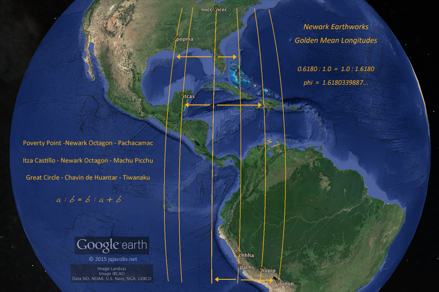
2009.01.09 - In 1991, I first noted the arc distance between Ohio's ancient Newark and Marietta earthworks equaled circumference (cir) of the earth divided by days per year. In part, excitement about this finding prompted improvement of my crude method, simply measuring maps. I was soon employing spherical trigonometry and traveling to university libraries, seeking out site plans and topographic maps to derive accurate monument coordinates. I confirmed the arc distance equaled cir/365.25, and I later noted the degrees longitude difference matched.
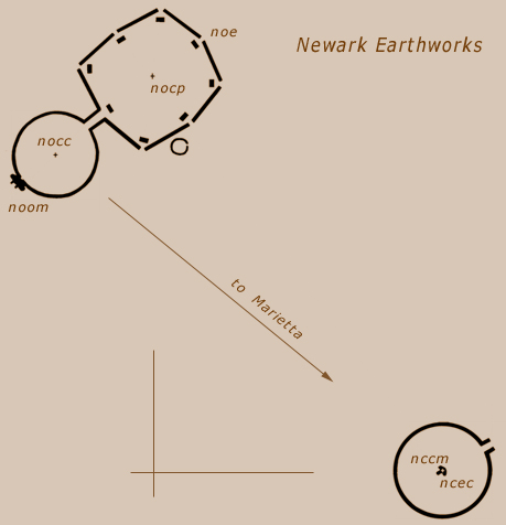
I took a great leap forward in methods in 2005, traveling to Ohio for GPS readings on the mounds, then confirming the GPS positions in Google Earth. Coordinates and site codes are appended below in Appendix A and the figures herein display the site codes. Technology had caught up with my hypothesis, so to speak, and using GPS data I repeated and expanded on a preliminary 2001 study, Possible Geodetic Properties and Relationships of Some Monumental Earthworks in the Middle Ohio Valley. Several Newark Octagon to Marietta relationships presented astronomical constants accurately. Not unlike grinding and polishing a lens, with each step in methods improvement, arc distances resolved more accurately in relation to astronomical constants. An ancient geodetic codex is now unveiling with some clarity, and this article discusses the research results. Some Newark study results are also compiled in a Google Earth file.

Marietta Conus Mound and Ellipse
Initial Findings
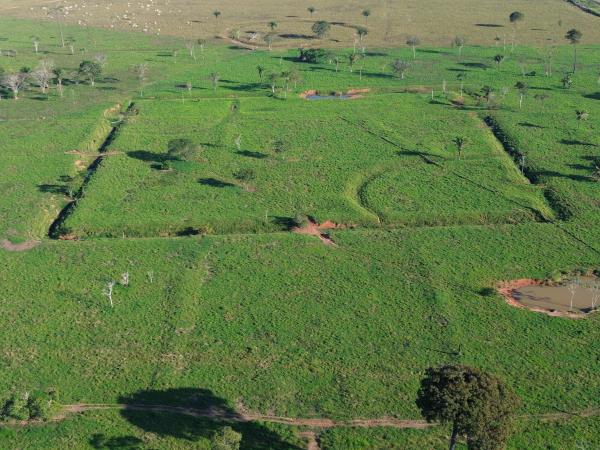
Initially I observed, on a National Geographic 1:267,000 map, the Newark-Marietta arc distance equaling circumference divided by days per year. With GPS coordinates and trigonometry, I also noted the arc distances from the Octagon to the two truncated pyramids in Marietta Square (Figure 1), Quadranau Mound (maqum) and Capitolium Mound (macam), match two lunar orbit values (Table 1). Significantly, lunar astronomy correlates with the capacity for navigation and longitude determination.
The Octagon centerpoint datum (nocp) is the average of the GPS readings for the eight embankment vertices. From the Octagon to Capitolium Mound, arc distance and degrees E - W (longitude difference) are equal. From the Octagon centerpoint the arc distance cir/365.24 and the same longitude difference converge within 250 feet of the center of Marietta Square, one of the largest Hopewell squares (1510' per Romain). From the Octagon centerpoint the arc distance cir/365.01 and the same longitude difference converge atop Marietta Capitolium mound, the high point of Marietta Works. In 365 lunar orbits, there are 10,000 rotations; the moon orbits 0.036501 circumferences per earth rotation.
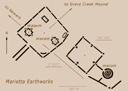
Figure 1. Marietta Earthworks |
Calendar keepers count days and years, or rotations, or moons. Astronomers count all these and more. Three fundamental astronomical motions, earth rotation and lunar and solar orbits, present the following ratios in integers; there are 10,000 rotations in 365 lunar orbits and in 366 there are 10,000 days. The two lunar orbit numbers, 365 and 366, are repeated in the Octagon to Marietta arcs, with Octagon-Quadranau arc equaling cir/366 and Octagon-Capitolium equaling both cir/365 and E-W cir/365 (Table 1).
There are 10,000 rotations in 365 lunar orbits,
and in 366 orbits there are 10,000 days.
| Table 1. Newark and Marietta Arcs |
| arc | arc |
E-W |
| Octagon - Capitolium | 0.9863° = cir / 365.0 | 0.9864° |
| Octagon - Quadranau | 0.9837° = cir / 366.0 | 0.9832° |
| lunar constant values | module |
| lunar orbits per rotation | r27 = 13.140381° = 0.036501 cir |
| lunar orbits per day | c27 = 13.176357° = 0.036601 cir |

Marietta Quadranau Mound
|
Fundamental astronomy is discussed in Eclipses, Cosmic Clockwork of the Ancients. A primer on fundamental astronomy in the Archaeogeodesy pages discusses formulas and precession. Appendix B below references the astronomy code terms and abbreviations herein.
The Ancient Earthworks of Eastern North America pages provide photo galleries, site descriptions, collected data, survey maps, references cited, and links to placemark and data files. Google Earth users can download survey drawing overlays of Squier and Davis 1848 earthworks survey maps. |
|


